26.12.2022 - 1.1.2023

Since I live in a rather flat area, I use the holiday season at the end of the year for a trip to the mountains.
The closest low mountain range to where I live is the Harz.
I was also hoping for a little more snow than normally falls in my neighborhood.
This time I concentrated primarily on DLFF areas.
Arrival/departure and accommodation ![]()
As accommodation and starting point for hikes I had chosen Schierke.
Although it is located in the middle of the Harz Mountains, this district belonging to Wernigerode is easily accessible from Wernigerode and from Braunlage by bus line 264 of the Harzer Verkehrsbetriebe (HVB).
The bus runs once an hour.
There I booked a room in the Pension Schmidt a few weeks before the trip.
![]() In many accommodations 2 € are to be paid as a tourist tax.
In return, you will receive the Harzer Urlaubsticket (HATIX).
It entitles you to free use of a variety of buses and trams throughout the Harz region.
In many accommodations 2 € are to be paid as a tourist tax.
In return, you will receive the Harzer Urlaubsticket (HATIX).
It entitles you to free use of a variety of buses and trams throughout the Harz region.
 You can also use the Harzer Schmalspurbahn (HSB) from Wernigerode or Nordhausen.
However, the above-mentioned HATIX ticket does not entitle you to travel on this train.
Overall, however, you can safely leave the car at home or at least at the accommodation on site.
Radio station ![]()
As station equipment I had an Elecraft KX3 with 5 W transmission power, a 6 m portable mast, a Palm Radio Single, a LiFePo4 battery with 3 Ah and various accessories in my luggage.
As an antenna for outdoor activities I use a doublet antenna.
Compared to the antenna also known as Twisted Hille in German QRP circles, I used an extended version with 2 × 9.5 m as a radiator and 8 m for the symmetrical supply line made of twisted wires.
Together with the 6 m long telescopic mast, this antenna can be set up well as an Inverted-V.
A few plastic pegs and short guy cords complete the antenna.
I did not use a balun because neither transceiver nor power supply are connected to the ground.
The entire station equipment for the SOTA activities, including mast and battery, weighs less than 2 kg.
DLFF-0608 Kramershai (27.12.2022) ![]()
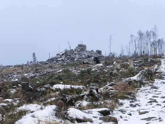
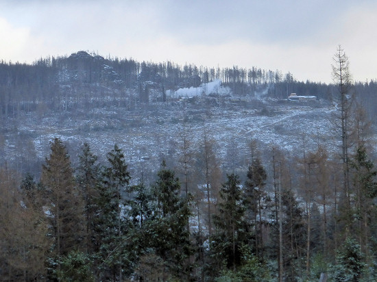 The mountain slopes around Schierke are almost all bare.
The fir forests that once stood there have largely fallen victim to the bark beetle.
Already from the village you can see, for example, the Mäuseklippe (GMA DA/SA-191, 670 m).
And behind Schierke station is completely free the Feuersteinklippe (GMA DA/SA-013, 761 m).
The whole circumference can be seen well from the Gestellweg.

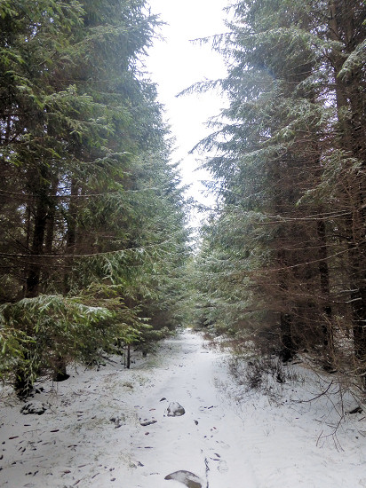
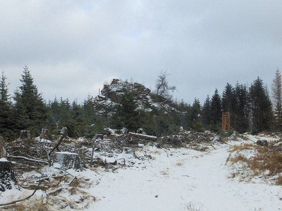 But there are also intact forest areas in between.
To me, however, their area seemed rather small compared to the extent of the free areas.
At the Kolonnenweg it was already over with the intact forest.
From the path you can see the Scherstorklippen (GMA DA/SA-190, 694 m), which are otherwise hidden between trees.

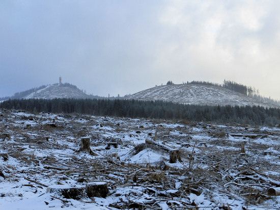 After 2.4 km I reached the 175 hectare large nature reserve Kramershai DLFF-0608.
This area was established to protect the highest red beeches in the Harz as well as the small-scale moor and spring areas.
However, at least the northern part is bare.
Apparently, the beech forests are to be found further south.
But from this point there was a clear view of the Wurmberg (SOTA DM/NS-001, 971 m) and the Kleine Winterberg (GMA DA/SA-009, 837 m).
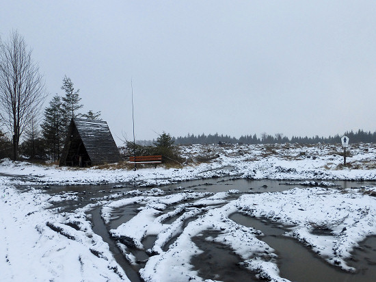
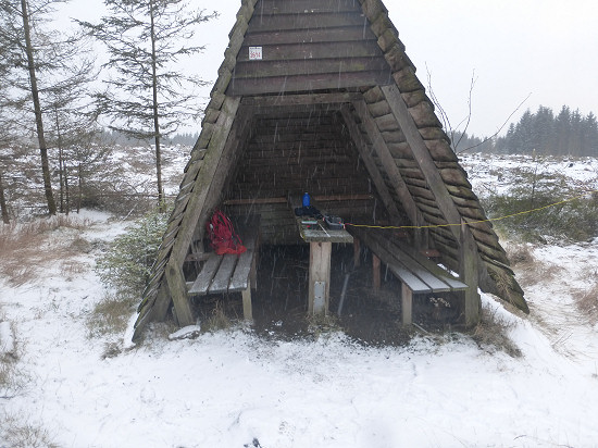 Directly on Ulmer Weg there is a refuge hut and a bench.
The hut served me as a welcome shelter during the onset of snowfall.
The mast was easy to attach to the bench.
Within ¾ hours I was able to reach 24 QSO's on 20 m mainly to stations in Central Europe.
But also EA, 9H, 4Z, and the East Coast of the USA were found in the logbook.
DLFF-0609 Harzer Bachtäler (28.12.2022) ![]()
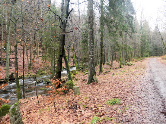
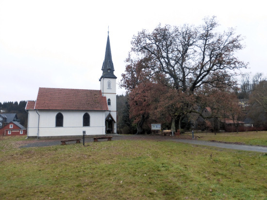 From Schierke, a 2.5 km long road runs parallel to the Kalte Bode.
The forests on both sides of the stream belong to the NSG Elendstal.
However, this area is not yet part of the DLFF programme.
The houses reached belong to misery.
This is a district of the city Oberharz am Brocken.
Built in 1897 in the centre of Elend, the church is the smallest wooden church in Germany, according to the Förderverein.
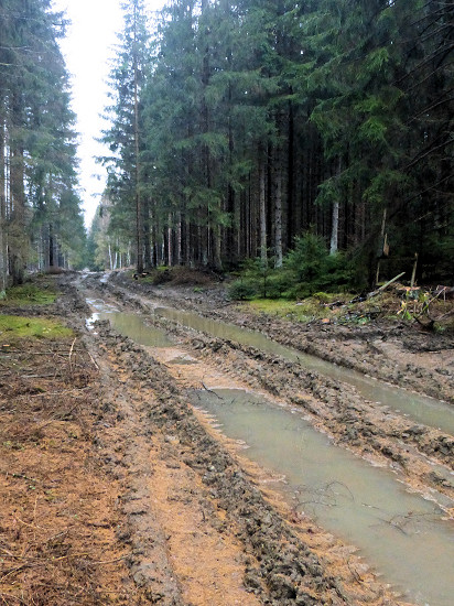
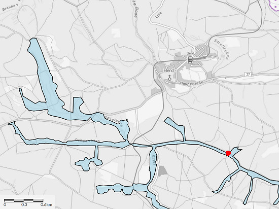 The fauna-flora-habitat Harzer Bachtäler DLFF-0609 includes a large part of the streams and rivers in the southwestern Harz.
Although usually only a relatively narrow shore area belongs to the habitat, it covers an area of 1301 hectares (≈13 km²).
 South of Elend there are still some fir forests, which have not yet become prey of the bark beetles.
I chose a wide forest path to the east, which was initially easy to walk.
But there is still forestry work there.
Due to the heavy vehicles used, however, the progress became increasingly difficult.
In the end, however, after a total of about 5 km on a wide forest road, I finally reached my destination: the banks of the Spielbach.
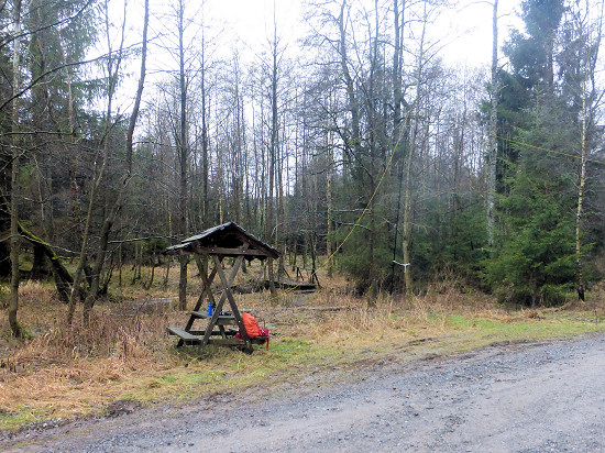
Right here is a picnic area that has seen better days.
But he offered space so that he did not have to operate the station sitting in the wet grass.
I attached the mast to a small tree.
With cloudy skies, gusty west winds, 4 °C and occasional light drizzle, I did not last long in one place.
So I could reach in ¾ hours on 20 and 30 m only 26 QSO to stations in Central Europe.
For the way back I initially used the wide road along the Spielbach.
Later it went through a side arm and over a small ridge back to Elend.
From there I used the path through the Elendstal valley to Schierke.
DLFF-0886 Naturpark Harz/Sachsen-Anhalt (29.12.2022) ![]()
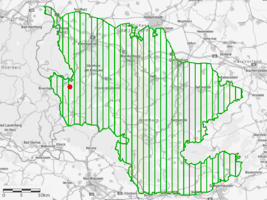
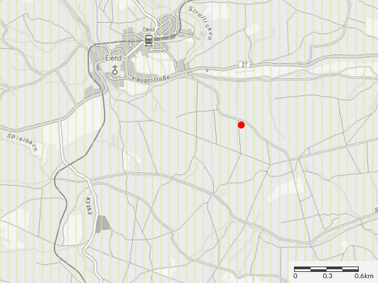 The Nature Park Harz/Saxony-Anhalt DLFF-0886 covers 1660 km², a large part of the Harz mountains lying on the territory of Saxony-Anhalt.
If you are traveling in the Harz Mountains, you always move away from those listed in the DLFF program in this area.
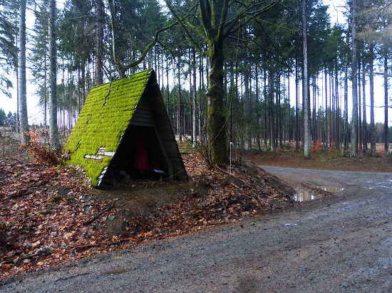 On this day it should be relatively warm with 7 °C, but rain often.
So I changed my tactics.
Tired of hiking the entire distance from the accommodation to the destination, I used public transport.
This time it was bus 264 that took me from Schierke to Elend/Kirche.
Although it was still raining when I arrived there, but when I reached the refuge chosen as my destination, the rain slowly subsided.
A little later I was able to set up the antennas in the dry.
A small tree next to the hut served as a fastening for the mast.
I stretched an antenna wire across the wide road.
Within 1¼ hours I was able to reach 22 QSO mainly on 20 m.
Some QSO's also reach 17 and 30 m.
In between, a falling branch tore down the antenna.
But since the wires remained intact, the antenna was quickly re-erected.
For the way back I used the bus from Elend/Kirche to Schierke.
Wernigerode (30.12.2022) ![]()
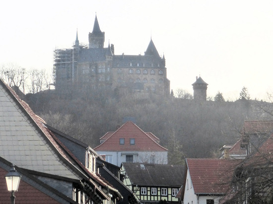 According to the weather forecast, it should stay dry on this day and even give some sun.
Therefore, I decided without further ado for a trip to Wernigerode.
With the bus 264 I quickly reached the place.
But apparently 10000 other tourists had the same idea, so that the small old town was relatively full of people.
Therefore, I only took a quick look at Wernigerode Castle (WCA DL-02132, SAB-001) and the trip was rather short.
Schierke (31.12.2022) ![]()
Actually, I wanted to hike on this day with 12 °°C very warm day finally on the Brocken (SOTA DM/SA-001, 1141 m) and thus in the National Park Harz (DLFF-0886).
I had already chosen some suitable places in the summit area.
But according to the weather forecast, there was a hurricane on the summit with wind speeds of about 120 km/h.
For this reason, the railway operation of the Harzer Schmalspurbahn (HSB) was discontinued.
Since even on lower mountains there was hardly any wind protection due to the bare mountain slopes, it remained with a short walk through Schierke.
Thanks ![]()
 My thanks go to all radio amateurs and SWLs who were able to pick up my quiet signals.
Even though hikes were in the foreground, it was again a lot of fun for me to be able to indulge in my hobby.
In the end, there were also 3 DLFF activations in the logbook.
Maybe I could help one or the other radio amateur or SWL to a new DXCC entitiy or at least to another item on one or the other list.
I have already updated the DL logbook.
The QSL cards will be filled out in the next few days and sent to all recipients via the QSL bureau.
73/72 de Ingo, DK3RED - Don't forget: the fun is the power!