12. - 18.2.2023
In the early morning I arrived in Feldkirch/Austria after a long train ride.
LIEmobil bus line 11 departs from the station forecourt.
Since I wanted to spend a whole week in the Principality of Liechtenstein, I immediately bought a weekly ticket.
This ticket currently costs 36 € for the entire country.
But you can get in anywhere, without having to have the right change for the ticket in your wallet every time.
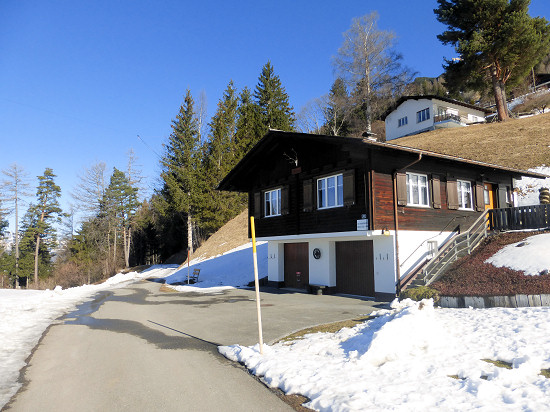 I had rented the holiday home Wanni for a week.
Contact information and details of the equipment can be found here.
The house is located on the slope of the Rhine Valley at 1244 m altitude right here.
It can be reached from the bus stop Masescha/Kapelle at the end of a narrow street.
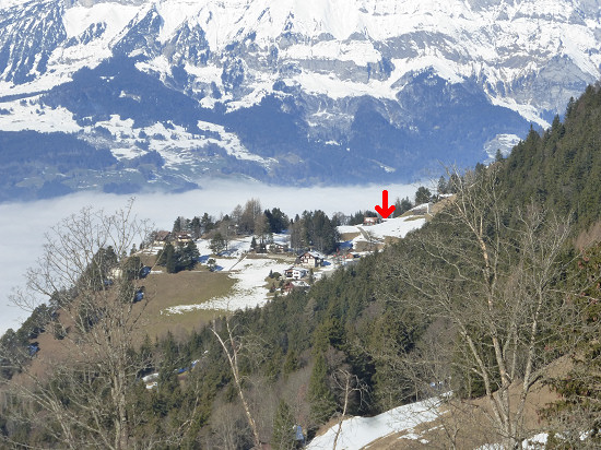 Around the house is space for antennas.
Therefore, I set up a 45 m long doublet antenna immediately after arrival.
For one anchoring point I use the tree about 25 m next to the house.
As a second anchoring point I used a tree at the edge of the pasture in front of the house.
But be careful! The trees stand on the edge of a steep slope.
If you throw the guy line into the tree with an object with full force, you may not get to the end.
I therefore threw the pierced golf ball with a thin auxiliary string attached to it over a relatively low branch, so that the ball remained accessible near the trunk.
With the help of the auxiliary cord, I then pulled the thicker mason's cord over the branch, which served for tensioning.
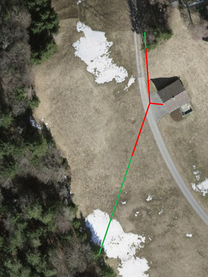 The holiday home has a projected gable roof.
Over the top beam I maneuvered the third guy line with the telescopic mast.
I connected these to the center of the Doublet antenna and the 12 m long two-wire cable attached to it.
I led the two-wire cable between window and frame wedged into one of the rooms.
But caution is also advised here, because the window frames are made of metal.
I therefore used one of the water slots, so that the cable is only surrounded by metal for a very short distance.
For radio activities outside the house, I had taken a 6 m long telescopic mast and a second, only 19 m long and particularly light doublet antenna.
I supplied the Elecraft KX3 (5 W, CW), which was used both in the holiday home and on the road, from a LiFePo4 battery with 12.8 V/3 Ah.
After a good meal in the Berggasthaus Matu, which is only 500 m away as the crow flies, but 220 m higher here, I tested the large antenna after sunset.
The antenna could be tuned on all bands from 80 to 10 m.
At 10 m I was able to reach a SOTA station on Saint Helena in the first QSO.
That was 7180 km distance on a band that, according to propagation forecasts, should no longer be usable at that time.
I reached some other stations in the comparatively closer area at 80 m.

Day 2 ![]()
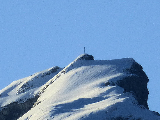 Already with the naked eye in the morning the narrow summit cross on the summit of the Rappenstein, about 7 km away, could be seen.
This indicated foehn and thus good weather conditions for hikes.
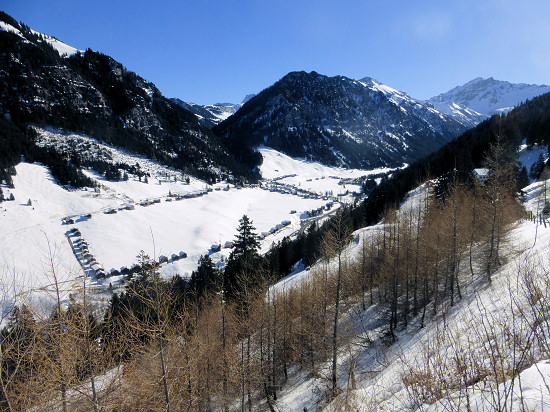 In the morning and early morning I reached some stations in Europe, mainly at 40 m, before I packed my backpack for a hike.
Already at home I had chosen some WWFF areas that I wanted to activate.
The first destination was the plant protection area (mountain flora) Sücka, Grosssteg, Bärgli Alp HBFF-0481.
It includes the mountain slopes and the wide valley in between.
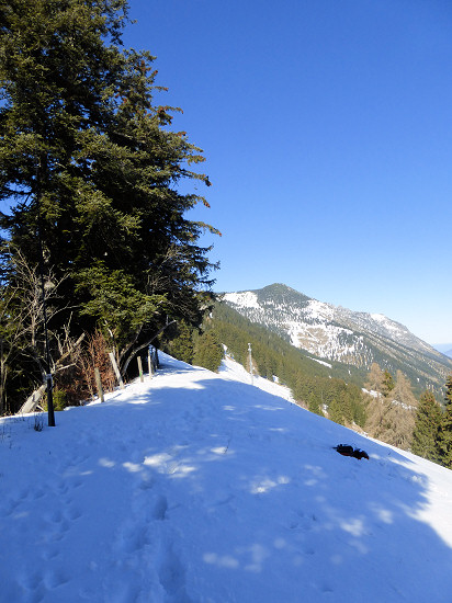
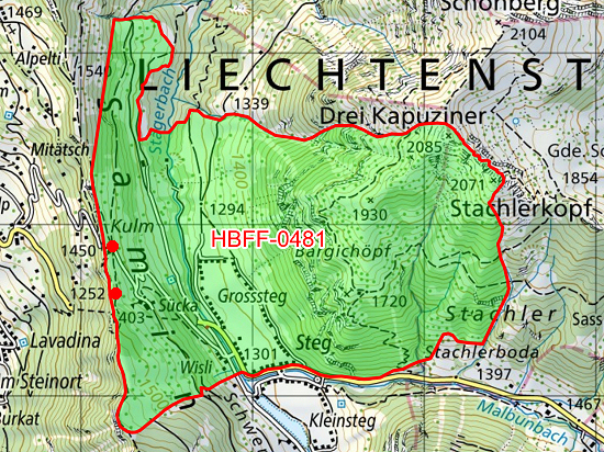 For the 3.2 km long way from the holiday home (1244 m) to the ridge (1460 m) above the Berggasthaus Matu Sücka I initially used the Philosophenweg to Mitätsch (1273 m) and to the old tunnel (1432 m) the Kulmstraße.
Directly on the ridge there is almost no shading by the surrounding mountains.
I attached the telescopic mast and the guying of the antenna to the fence posts right here, which were not used in winter.
However, a suitable work surface turned out to be a problem.
I slide down the slope again and again in deep snow.
After 1 hour and 29 QSO's at 20 m I finished the activation.
I started the 5.2 km long way back via Silum (1483 m) and the Berggasthaus Matu (1453 m) before I reached the holiday home again at 1244 m.
In the evening I reached some QSO's to European stations at 20, 40 and 80 m.
Day 3 ![]()
 After some QSO's at 80 m in the morning I started again to HBFF-0481.
This time I started the hike at the bus station Steg/Tunnel (1277 m).
From there I used the road, which was partly used as a toboggan run, to the old tunnel (1432 m).
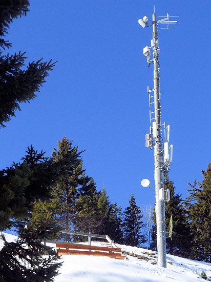
I planned to sit down on the bench a few meters higher.
But my antenna would then be in the beam direction of the antenna mounted on the transmission mast.
So I chose the seat here directly at the tunnel exit.
This time I attached the mast and antenna to the wooden railing.
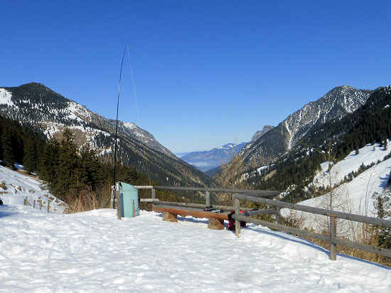 In 1½ hours I get another 23 QSO's on 15, 20, 30 and 40 m.
This time I completed the way back via the Kulmstraße down to Mitätsch (1273 m) and then via the Philosophenweg back to the holiday home.
The total distance this time was only 4.2 km long.
In the evening I get 2 QSO's to the east coast of the USA (7540 and 7880 km) and 1 QSO to Mali (4170 km) on 10 m.
Day 4 ![]()
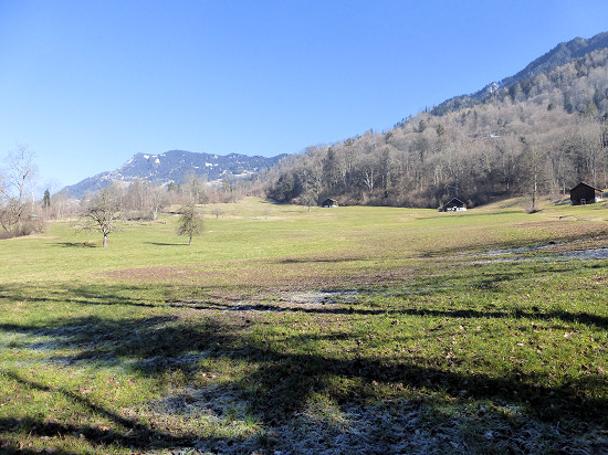 After 2 QSO's at 80 m in the morning I took the bus to the Rhine Valley.
There is the protected area Periol, Bofel, Neufeld, Undera Forst HBFF-0478.
I started the hike at the bus station Triesen/Gartnetschhof (473 m).
After a short detour to the nearby Rhine, I reached here a bench (542 m) via the Langgasse, the Bofelweg and the Periolweg.
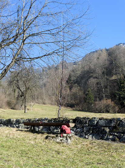
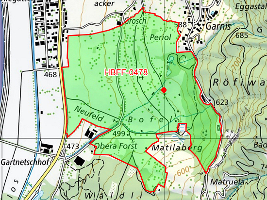 I attached the mast to a small tree above a stone wall.
Although it was still hazy and relatively cool in the valley at first, it became pleasantly warm when the sun came through.
In 2¼ hours 51 QSO's were achieved on 20 m.
I finished the 2.8 km long hike at the bus station Triesen/Bächlegatter (466 m).
After sunset I switched on the station in the holiday home again.
On 10 m I managed to connect to Uruguay (11000 km).
Day 5 ![]()
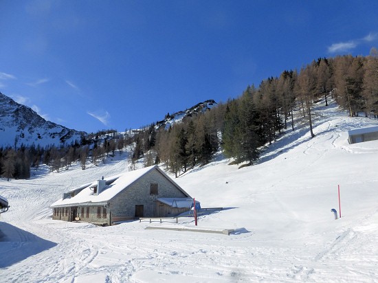
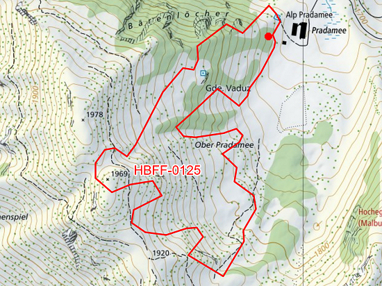 Above Malbun lies the Alp Pradamee, which is not managed in winter.
The slopes above the alp belong to the forest reserve Pradamee HBFF-0125.
This time I started the hike at the bus stop Malbun/Jöraboda (1599 m).
From there, a wide road leads to the alp, which, however, is covered in deep snow in winter and leads over several ski slopes.
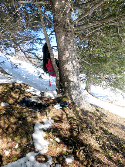
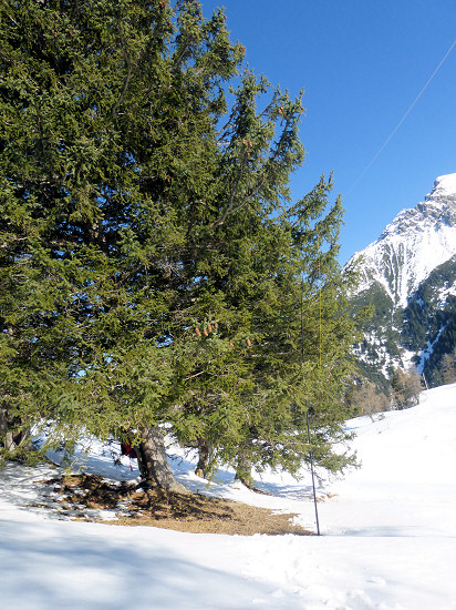 Since the upper areas of the forest reserve are winter rest zones from December to April according to a sign, I looked for a suitable place in the lower area here at 1733 m altitude under one of the trees.
I attached the mast at a height of 2 m to one of the low-hanging branches.
Since he was stuck in the snow below, he did not slip away.
Sitting on a snow-free surface, the station was easy to operate and the log was managed.
Initially, the slope was illuminated by the sun.
But later it lay in the shadow of the mountain.
Nevertheless, I get 51 QSO's to 20 m in 1½ hours.
For the way back I used the same way to the bus stop.
Day 6 ![]()
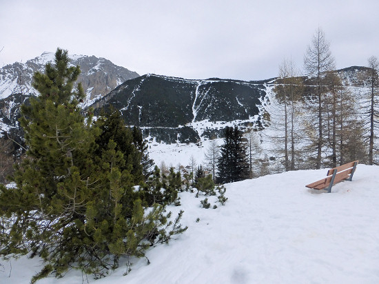 In the morning the already announced clouds could be seen.
But according to the weather report, no rain should fall.
So after the morning QSO's at 80 m I started the hike at the bus station Malbun/Jöraboda (1599 m).
For the first section I used the path from the previous day.
We continued on another, snow-covered road and across to other ski slopes.
Already in summer I had activated the special forest reserve Alta Stofel HBFF-0229.
To set up the station, I wanted to use the bench right here in the upper area again.
But when I arrived crossing deep snow and ski slopes, drizzle set in.
In combination with the wind blowing through the Täli basin, I did not want to sit there any longer.
Therefore, I went on the shortest route over the closest, very steep ski slope back down to the bus station.
Back at the holiday home I was able to reach almost 50 QSO's at 10, 15, 30, 40 and 80 m, which not count for WWFF.
Day 7 ![]()
 In the morning I reached 15 QSO's at 80 m mainly to the east coast of the USA and Canada.
The operators there were very active in the ARRL International DX Contest.
But at some point it was time to dismantle the antenna and make its way to Feldkirch/Austria station.
The train ride started at lunchtime and I arrived home in the early evening.
In the end, there are 326 more QSO's in the logbook, of which I reached 172 from the holiday home and 154 from the 3 activated WWFF areas.
I was active on 6 bands: 80 m (68), 40 m (53), 30 m (23), 20 m (160), 15 m (15), 10 m (7).
The number of QSO's achieved is indicated in brackets.
In total, I reached 36 DXCC entities: 4X (1), 9A (8), CX (1), DL (64), E7 (1), EA (7), EI (1), F (11), G (17), GM (3), GU (1), GW (1), HA (3), HB (9), I (32), LZ (6), OE (2), OH (20), OK (13), OM (12), ON (12), OZ (6), PA (7), RAeu (3), S5 (13), SM (7), SP (20), SV (1), TZ (1), UR (8), VE (2), W (24), YL (2), YO (2), YU (4), ZD7 (1).
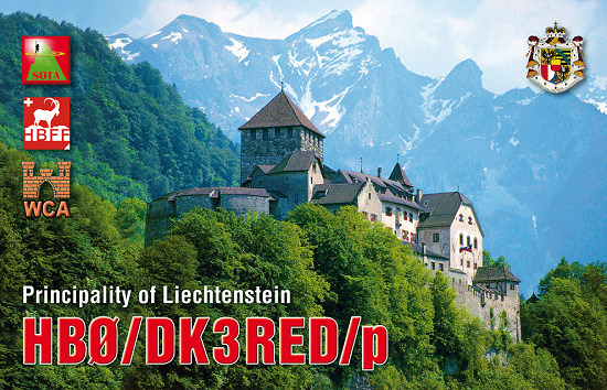 In the meantime, I transferred all achieved connections from the paper log to the HB0 logbook and sent the QSO's achieved in WWFF areas to the HBFF manager.
In the coming days I will fill out the QSL cards produced by the QSL shop and send them on their way via the bureau.
Finally, I would like to thank everyone who was able to pick up and answer my quiet signals.
73/72 de Ingo, DK3RED - Don't forget: the fun is the power!
Addendum on 23.2.2023: All QSL cards was sent today directly or via the QSL bureau.
Addendum on 17.11.2023: The 11 rated QSOs on 80 m on day 7 earned me place 2 worldwide in the Single Operator QRP 80 m category.
The certificate is inserted at the top.