6. - 13.11.2022
 The time of year has arrived again, when it is often cool and wet.
Longer outdoor radio activities are therefore not always a pleasure.
Nevertheless, after a longer break, I want to bring a few new DLFF areas into the air.
Therefore, this report continues after each DLFF activation.
Unless otherwise noted, an Elecraft KX3 with 5 W output power in CW was used.
The antenna was a 19 m Doublet, which I stretched as Inverted V on a 6 m mast.
DLFF-0276 Jägersberg-Schirknitzberg (6.11.2022) ![]()
The weather forecast promised after a quite cool night with 4 °C for the day only up to 12 °C.
However, it should be sunny for 8 hours, rain only 10 % and only a moderate southerly wind with 2 to 3 Bft (10 to 15 km/h).
Therefore, I took the train and a bicycle to Wünsdorf, more precisely to the railway station Wünsdorf-Waldstadt.
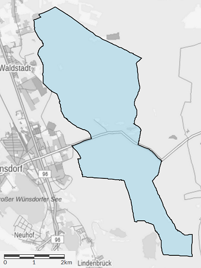 On the western outskirts of the village stretches the 1597 hectare (≈16 km²) nature reserve Jägersberg-Schirknitzberg DLFF-0276.
From the railway station I followed the main avenue (highway L74) to the east and quickly reached the targeted area.
It includes to a large extent the pine forests common here in the state of Brandenburg.
After about 3 km I reached the parking lot, from where the "Zehrensdorf Indian Cemetery" can be reached.
This is a cemetery for Indian prisoners of the First World War.
At the parking lot I wanted to turn south, but the path marked on the map is overgrown.
Therefore, I drove back a 200 m and then continued on a path probably once reserved for military vehicles.
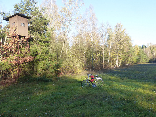 After another 1.2 km I set up the station on a clearing parallel to the path right here.
I chose a point already illuminated by the sun near a hunting perch.
As a construction surface I used the bicycle itself.
The antenna mast could be attached to the bench of a small pine tree.
Although the sun had meanwhile risen completely over the trees and I was halfway sheltered from the wind, my fingers became clammy at 6 to 7 °C over time.
Since these are bad conditions to do Morse code, I dismantled the station after about 1¾ hours.
In the end, there were 50 more QSO's on stations in Central Europe in the logbook, half at 30 and half at 40 m.
However, I did not drive back to the railway station, but headed for the next, directly adjacent DLFF area.
DLFF-0926 Großer und Kleiner Möggelinsee (6.11.2022) ![]()
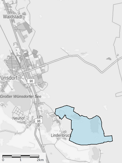
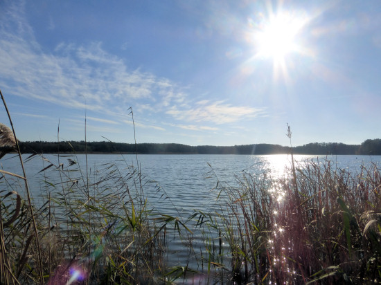 Southwest of Wünsdorf stretches another area of interest for radio amateurs: the 335 hectare nature reserve Großer und Kleiner Möggelinsee DLFF-0926.
First I looked at the north shore of the Großer Möggelinsee.
It was full in the sun, but the wind blew unpleasantly cool over the lake.
For a few minutes it was bearable there, but I did not want to stay there for a long time.
Therefore, I drove further south on the wide roadway on the west shore.
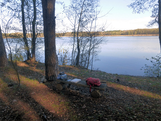 This path initially leads through a swampy forest area, but the environment becomes drier after a while.
In the immediate vicinity of the shore of the Großer Möggelinsee there is a bench between tall pines right here.
I used this to set up the station.
If you were attentive, you have already discovered the bench about 100 m before on a hill about 5 m above the lake.
The station could also be built there.
Luckily for me, I "occupied" the bank on the shore before other interested parties arrived.
This DLFF area has not yet been activated.
Therefore, the pile-up was at times hardly manageable.
At some point, the loud jostlers were gone and operating became more pleasant.

Unfortunately, the location was mostly in the shade and only a few rays of sunshine penetrated to me.
Therefore, although it had become a bit warmer with 10 to 11 °C, I switched off the transceiver again after 1¾ hours.
This time there were 52 more QSO's in the logbook, of which ¾ on 20 m, the rest on 30 m.
During the dismantling of the station, an "official-looking" man appeared in a car.
He asked from the rolled down window if I would fish here.
After the answer that I was only on the hunt for other radio stations, he pointed to the antenna still partially hanging in the tree and muttered something like "With the wires there?".
After saying yes, his curiosity seemed satisfied, although the telescopic mast that had been pushed together was still on the bench.
He drove away as greetingly as he had come.
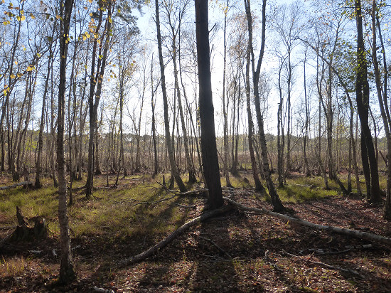 For the way back, I initially chose a forest path along the Kleiner Möggelinsee.
This lake seems to be completely overgrown with reedbeds.
In any case, I could not discover an open water surface.
Later I changed to a wide road in the forest and finally to the federal road B96.
The route from the shore of the Großer Möggelinsee to railway station Wünsdorf-Waldstadt is 5.9 km long.
At the end of the bicycle tour through both DLFF areas, 14 km were on the odometer.
DLFF-0510 - Untere Havel Nord (13.11.2022) ![]()
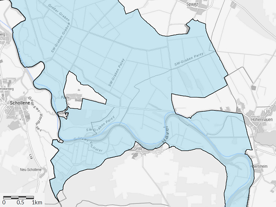 Along the Havel lies the 4707 hectare (≈47 km²) nature reserve Untere Havel Nord DLFF-0510.
It stretches from the city boundary of Rathenow to the river Dosse.
Although the area lies within the Westhavelland Nature Park DLFF-0133, it counts separately.
The weather forecast promised after 2 °C at night for the day a maximum of 10 °C, 40 % rain, overcast sky and moderate to weak east wind with 3 to 2 Bft (15 to 10 km/h).
Since I only wanted to head for a DLFF area this time, I started the bicyvle tour relatively late in the morning.
I started at railway station Rathenow.
On the route via Göttlin to Grütz, relatively small roads can be used outside the city and through the eastern tip of the Klietz military training area.
Behind Grütz it continued for the rest of the 12.4 km long way on wide roads.
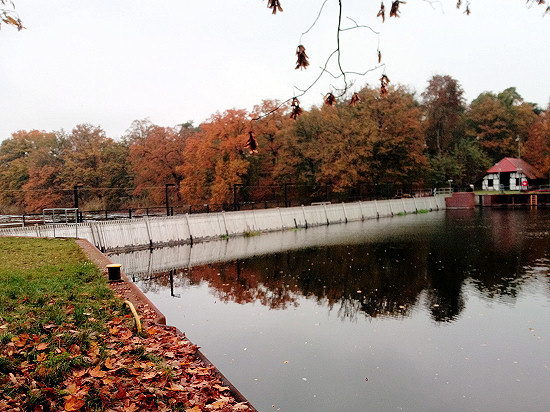 As a destination I had chosen a place near the lockage Grütz.
There, in the southern circumfluence around the lock basin, there is a special structure: a needle weir.
According to various sources, there are only 5 of these weirs left in the state of Brandenburg.
Even in the whole of Germany, only 10 of these weirs equipped with vertical planks are said to exist.
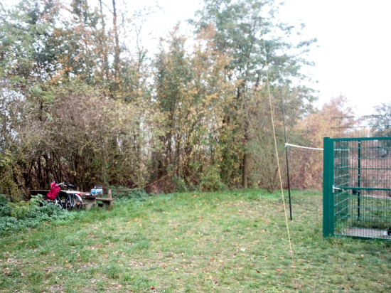 At the southern end of the weir there is here a picnic place that has seen better times.
But the two wooden benches and the wooden table were still sufficiently stable for the station and for me.
I attached the mast to the grid that prevents visitors from entering the weir.
There was a contest going on this weekend.
However, since I specifically called for WWFF connections, no one answered me on the classic bands.
At 17 m, even after a longer time, only a single station, but 1650 km away, answered.
So at some point I switched to 30 m.
Even on this otherwise productive tape I could only log stations very slowly.
When I dismantled the station after 2¾ hours "frozen", there were only 34 QSO's more in the logbook.
For the way back I wanted to use a path that starts at the weir and leads directly along the Havel.
But already the first stretch to an allotment garden colony turned out to be a half-overgrown trail.
Since I did not want to push the bicycle, I dycled back the already known way and changed to the Havel cycle path before Grütz.
It leads to Göttlin along the edge of a forest with a view of the Havel.
From Göttlin I used the already known roads to railway station Rathenow.
Although this way back was a bit longer with 14.6 km, you can drive quite a long time near the Havel.
73/72 de Ingo, DK3RED - Don't forget: the fun is the power!