15. - 31.7.2022
It was only in the middle of last year that I discovered radio activations as part of the WWFF programme.
Before, it was just information that I sometimes received from other stations and noted in the logbook.
Depending on the situation, all WWFF activations have so far taken place in their own country and from DLFF areas.
That was to change now, because travel was possible again to a limited extent.
And as a lowland dweller, I was drawn back to the mountains in Liechtenstein.
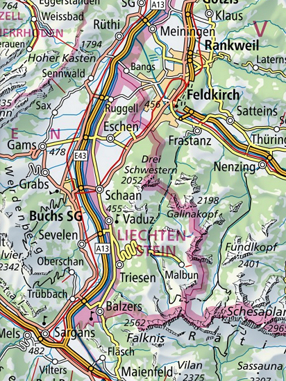 The main goal was to relax while hiking through the Principality of Liechtenstein, which is now well known to me.
Of course, I also had a small radio station with me, which could still be stowed in the backpack.
Below I have listed the individual hikes and described paths that led to the respective destination.
This time I did not list distances and the time required for each.
Nevertheless, I hope to encourage one or the other to visit this country, which is not only interesting for radio amateurs.
For preparation and the used station, I give a few tips and information at the end of this page.
Day 1: Arrival ![]()
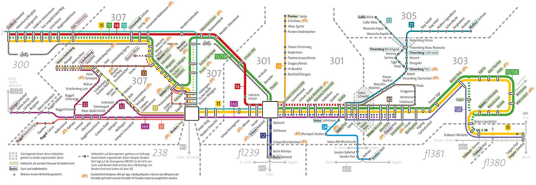 In previous years, I always boarded the ÖBB night train to Zurich the evening before and continued to Sargans/Switzerland in the morning.
This time I had opted for a very early departing ICE, which was followed by an RE and finally a regional train to Feldkirch/Austria.
The green buses from LIEmobil also run to Sargans and Feldkirch.
Since I wanted to stay in Liechtenstein for 17 days and would therefore often be on the road with one or the other bus, I bought a monthly ticket for 72 CHF.
This purchase had paid off in the end.
And I didn't have to have change for the bus all the time.
In the afternoon I arrived in Gaflei.
This is a district of Triesenberg, which lies at about 1450 to 1480 m altitude.
During my vacation, I stayed there with friends who had invited me to stay in their house.
But especially in the slightly lower district of Masescha you can rent various holiday homes.
Some landlords there now know radio amateurs and their preference to stretch wires to the trees and to set up poles without a flag on them.
In the end, it should be possible to find a suitable accommodation for a shorter or longer stay for every radio amateur.

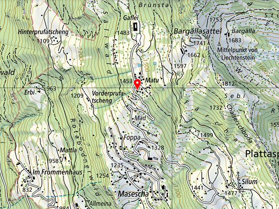 The Berggasthaus Matu always served as a refreshment point for me, because it was relatively close to the accommodation.
It is located here at an altitude of 1453 m.
It is open from 10 o#clock and invites you to eat throughout.
Monika and Werner Schädler, the operators, were already known to me from Berggasthaus Sücka and always had positive memories.
And the food as well as the service were again outstanding.
In addition, you can sit comfortably on the terrace and look out over the Rhine Valley.
The Gaflei car park is one of the starting points for hikes along the Fürstensteig.
From this the mountain inn is only 400 m away.
A little tip: Even if you don't have accommodation nearby, you should still stop there during a hike or radio activity nearby.
The bus stop Matu of line 22 from Triesenberg to Gaflei is one stop in front of the end and right outside the front door.
Therefore, you can even leave the car at home.
Day 2: Station setup and warm-up ![]()
In order to be prepared for possible bad weather days, I set up a double antenna along the property line in the morning.
Due to the limited area, only an antenna with 2 × 24.5 m and 8 m long feedline could be accommodated, which I also had to bend to the wire ends.
Due to the proximity to the other residential buildings, disturbances caused by electrical devices that could not be determined in more detail were unavoidable.
But since I wanted to operate mainly on the go anyway, this fact did not matter.

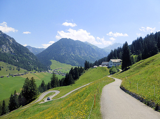 As an easy start, I took a hike to Steg.
From Gaflei, two ways can be used.
Both paths lead via Silum (1477 m), from which there was a good panoramic view over the Rhine Valley.
I used the path where you can get there and back without big climbs.
If you hike above Silum over the ridge of the ridge, you can take a look at the Samina Valley and the Valüna Valley as well as the Schönberg at the viewpoint (1540 m).
The turning point was the Berggasthaus Sücka (1402 m), where no overnight stays are currently possible.
You can only strengthen yourself physically or quench your thirst there on weekends.

Day 3: Moggawald/Schwarzwald HBFF-0228 ![]()
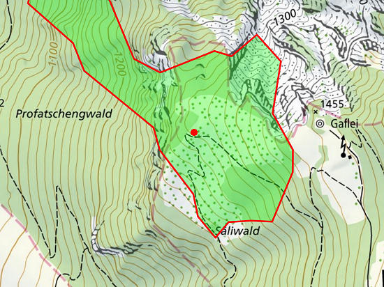 Below Alpspitz (1996 m) and Gafleispitz (1982 m), a protective forest stretches directly on the steeply rising rock face, the Moggawald/Black Forest HBFF-0228.
From the Gaflei car park (1483 m) you can reach the southern end of the forest if you take the path towards Hinterprufatscheng from there and turn into the forest at the lookout tower.
On a rather loose area with trees, I built the station.
Sitting comfortably in the shade of a tree found within 2½ hours on 30 m 45 QSO's entrance into the logbook.
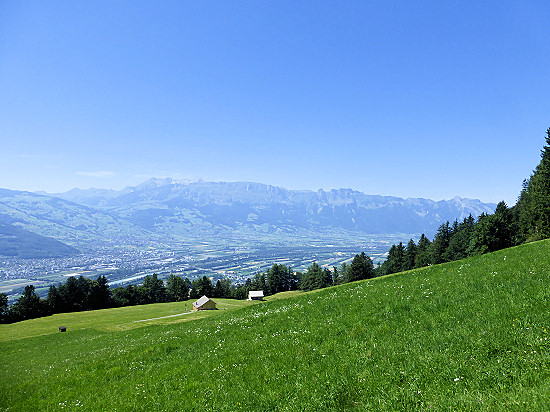 For the way back I used the hiking trail leading down in serpentines to Hinterprufatscheng (1109 m).
Via this path you can also reach the Wildschloss and Vaduz.
But I had planned this hike for a later day.
From Hinterprufatscheng I used comfortable roads and roads through Rotenboden to Triesenberg (884 m).
From there the bus took me back up to Gaflei (1483 m).
Day 4: Färchaegg without reference ![]()
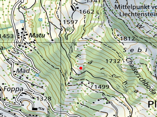 It was just too warm, even in the mountains.
Therefore, I looked for a shady spot at the Färchaegg.
You can reach this point by walking from the Gaflei car park (1483 m) in the direction of Alp Bargälla and turning off at the junction Vorder Bargälla (1593 m) to Gaflei.
On a wide road you can easily reach the free area known as Färcha.
There is also a bank right on the way.
But I was still a bit pulled up the slope.
On the one hand, this offers a better view of the mountains in the south of Liechtenstein, which is not possible from the way through the quite tall trees.
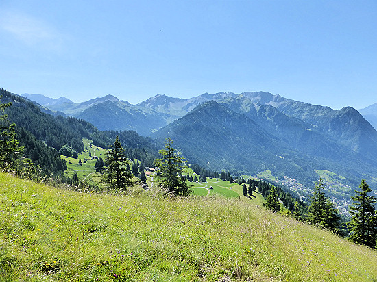 On the other hand, there is a hunting lodge near a tree.
I settled down in his shadow and set up the station.
Although the radio operation from there counted neither for HBFF nor for SOTA and I could not give a reference as an extra bonus.
But it was still fun.
In 3 hours I was able to reach another 20 stations mainly at 30 m but also at 20 m.
For the way back I use the same way.
Cooling brought various cold drinks in the Berggasthaus Matu.
Day 5: Aslamagee HBFF-0273 ![]()
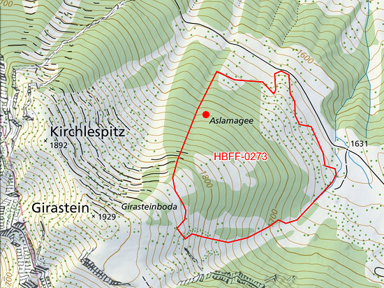 North of Malbun is the protective forest Aslamagee HBFF-0273.
As a starting point I chose the bus station Malbun Zentrum (1600 m) of line 21.
From there, a wide road leads to Alp Pradamee.
Shortly before the alp, a path branches off to the west at 1705 m, which you follow to the second cattle trough.
A little above on the slope is a dense forest, the Aslamagee.
Since there is no signposted path up, you have to move up over the cattle pasture.
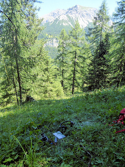 The slope of the Aslamagee is steep and inclined to the north.
I ended up choosing a position, were no more cow patties.
The area was too steep for the four-legged friends.
Within 2½ hours I was able to reach 46 QSO's, mostly at 30 and 20 m, but one also at 40 m.
Stations from the southern DXCC entities were absent as expected, as the mountain ridge in this direction shielded their signals.
For the way back, I actually wanted to continue using the road to get to Steg on this way.
But after the wooden barrier at the next incision, the slopes on the right and left became steeper and steeper.
The path ended abruptly and before continuing through the forest I looked off.
Instead, I used the same way back to the bus stop.
Day 6: Garsaelli/Zegerberg HBFF-0126 and Hellwangspitz HB0/LI-011 ![]()
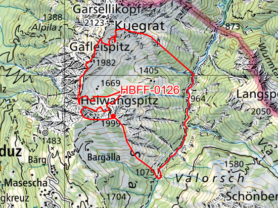 Above Gaflei is the Hellwangspitz HB0/LI-011, which counts for the SOTA program.
As stated on the HBFF website, the summit is located on the edge but within the forest reserve Garsaelli/Zegerberg HBFF-0126.
From the Gaflei car park (1483 m) it goes in serpentines on a wide road past the Alp Bargälla (1662 m) to the Bargällasattel (1742 m).
If you cross this saddle, you can already see the Alpspitz (1996 m) on the left and the Hellwangspitz (2000 m) on the right.
A screech hiking trail leads to the latter summit.
Over the Kamin (1937 m) down you reach the Gafleisattel (1856 m), the upper end of the Fürstensteig, or further to Gafleispitz (1982 m), Kuegrat (2123 m), Garsellikopf (2105 m) and the Drei Schwestern (2047, 2052, 2034 m).
Zu dem zuletzt genannten Gipfel führt ein gerölliger Wanderweg.
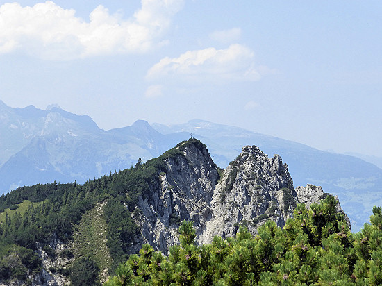
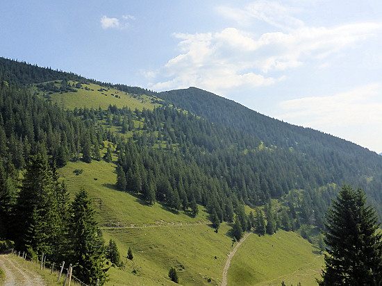 At the Kamin, the path continues behind the stop sign.
From here it is an unmarked, but also not to be missed narrow path.
It leads through a dense forest with low mountain pines.
The Hellwangspitz (2000 m) does not offer an imposing summit cross like the Alpspitz (1996 m), which can be seen from there.
But he has at least one summit stone and a summit book.
On a small clearing near the summit I built the station.
Within 2 hours I was able to reach 31 QSO's at 20 m.
For the way back I used the same way.
It should be noted that the Hellwangspitz is only accessible between mid-April and mid-December.
The rest of the time it is in a wildlife rest zone, which is indicated by the stop sign on the Kamin.
In addition, you should keep in mind that the slope is inclined to the south and the mountain pines offer very little sun protection, especially in summer.

Day 7: Gantenstein HBFF-0121 and Schellenberg/Eschnerberg HB0/LI-012 ![]()
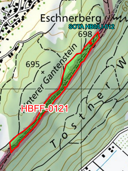 Near the village of Schellenberg is another peak that counts for the SOTA program.
It is the 698 m high Eschnerberg HB0/LI-012, which erroneously bears the name Schellenberg.
But that is the name of the entire mountain plateau.
On the south side of the plateau there is also a narrow but long strip of forest: the protective forest Gantenstein HBFF-0121.
In the area around the summit, the area valid for SOTA activation overlaps with that of the HBFF area.
This summit is always accessible, even if you are not on foot.
I took the bus to the stop Schellenberg/Sägaplatz.
This stop can be reached from Ruggell/Rathaus (line 32), Mauren/Post (line 33) and Bendern/Post (line 35).
There is also a large parking lot.
From Sägaplatz (650 m) there is a path to the ruins of Upper Castle Schellenberg (664 m), which also bears the name Neue Burg Schellenberg.
Although there are only a few walls left, the view towards Austria is worth a short jump up.
There is another ruin on the Schellenberg Plateau, but so far in the WCA list only one entry existed.
The ruin Untere Burg Schellenberg (590 m) is located almost exactly to the west at a distance of 900 m.
Therefore, I informed UA1CIO, the WCA list manager, of this fact by e-mail.
He immediately clarified the list and added a new entry.
Accordingly, the ruin in front of which one is currently standing is the newly entered hb0-00005 "Ruine Neu-Schellenberg" (Upper Castle Schellenberg).
The WCA object on the other side of the plateau is the one already entered in the list.
The name has been clarified to avoid confusion.
It is now HB0-00002, "Alt-Schellenberg" (Lower Castle Schellenberg).
Thanks to Vladimir, UA1CCIO, for clarifying and supplementing the WCA list!

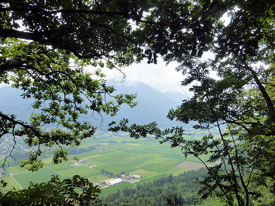 At the foot of the ruins you continue on the Historical High Trail.
The Gantenstein (695 m) with the boulder, which gives its name to the HBFF area, is a bit off the beaten track.
Shortly before the border to Austria you reach a square where there are two telescopes next to the information board "Kulturraum Feldkirch".
The elevation behind the visitor is the Eschnerberg/Schellenberg (698 m).
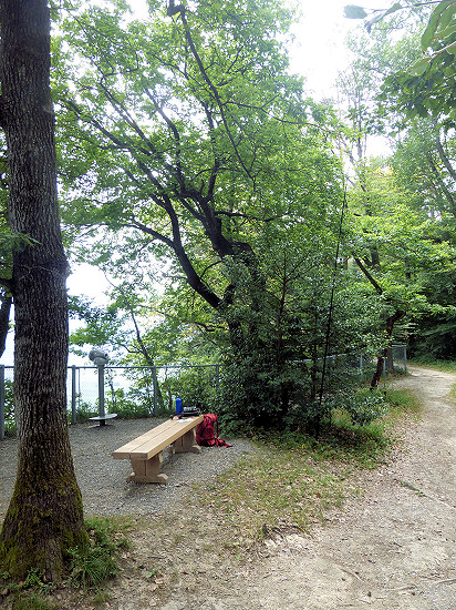 The summit is very flat and relatively heavily forested.
In addition, it has neither a summit stone nor a summit cross.
It is therefore far from being spectacular, especially since you do not even have a good view directly from the top.
Nor is there any reference to the summit.
For the construction of the station I used the wooden bench at the viewpoint.
It is only about 3 m lower than the summit and in the HBFF area.
I attached the telescopic mast to a larger shrub right next to the bench.
Within just over 3 hours I was able to reach a total of 51 QSO's at 20, 30 and 40 m.
Day 8: Säliwald HBFF-0120 ![]()
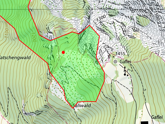
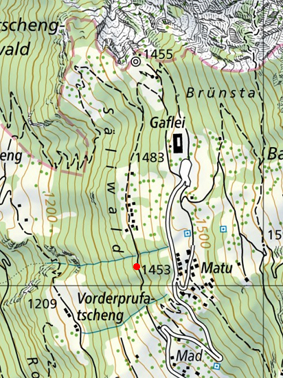 From Gaflei down the slope is the protection forest Säliwald HBFF-0120.
Already from the distance to my accommodation it was obvious to activate this area once.
From the road between Masescha and Gaflei I used a wide road starting there.
It leads past the launch site of the gliders and ends at the open space "Obmatu" at an altitude of 1401 m, which does not belong to the HBFF area, as it stands at one of the huts standing there.
On the other side of the meadow, a narrow path begins at the edge of the forest, which leads to the Gaflei lookout tower.
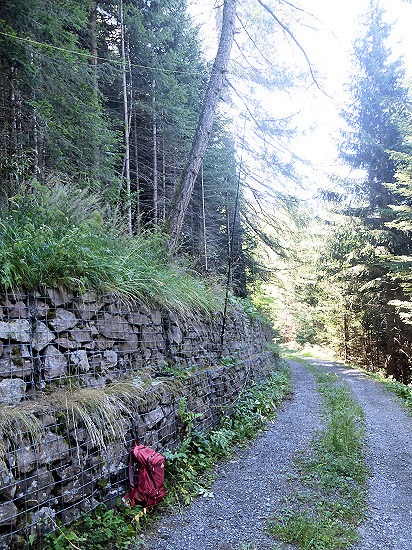 I looked for a place in the shade with a protective wall.
I attach the mast to the grid with a rubber band that holds the stones of the barrier.
I stretched the Inverted-V above the barrier and thus quite close to the steeply rising hand behind it.
I placed the station on the first step of the protective wall, which is located at a comfortable height.
In addition, the relatively wide step provided space for the paper log.
Within 3 hours I was able to get a total of 38 QSO's at 40, 30 and 20 m, with only a few reaching 30 m.
For the way back I used the same way.
Day 9: Matilaberg HBFF-0222 ![]()
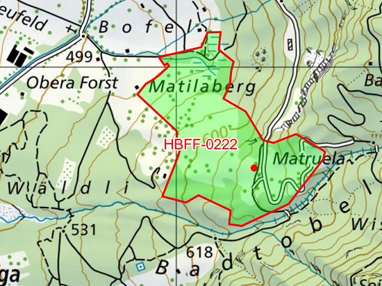
 Many hiking trails start near the bus stop Triesen/Säga (470 m).
From there, for example, you can reach the Wangerberg in 2 hours and the Lawena in 4 hours.
My destination was not quite so far away.
After the campsite Säga I used a road that leads uphill in serpentines on the Badtobel.
Over a stone bridge you can change the shore.
Then you are already in the protective forest Matilaberg HBFF-0222.
This is an area where there is a large meadow on which there are isolated trees.
The meadow is surrounded by a dense forest.
I built the station on the remains of a building, which are located near the path on a meadow.
But from there I was driven away by leaf blowers, with which 2 farmers blew up the slow-drying hay.
In the end, when I could hardly hear the calls even with headphones, I changed location.
I settled a little further down the slope under a large tree.
There is even a bank there.
In the end, the noise drove me away from there as well.
But before that, I was able to reach 44 QSO's in 2 hours, mostly at 40 m, one also at 17 m.
For the way back I used the same way.

Day 10: Säliwald HBFF-0120 ![]()
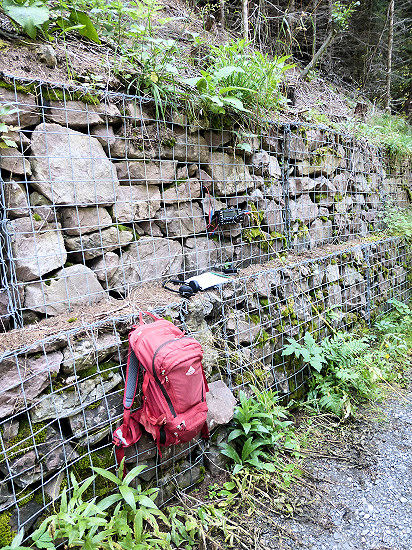
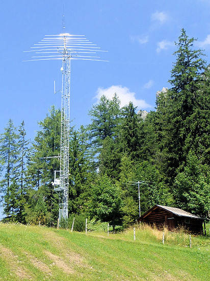 On this day I used again the protective forest Säliwald HBFF-0120, which is almost on the doorstep, as already 2 days before.
I put the station back on the lowest level of the protective wall.
This time, however, I set up the antenna on the other side of the path, so that the wires were relatively far from the slope.
Nevertheless, in 1½ hours I could only reach a total of 9 QSO's at 40 and 17 m.
This time I used the way back over the meadow "Obmatu" (1401 m) and at the opposite edge of the forest the path that leads to the viewpoint Gaflei (1455 m).
The imposing antenna forest planted there on a meadow belongs to the club station of the Amateurfunkvereins Liechtenstein (AFVL).
Day 11: Sareis without operation ![]()
Looking out of the window in the morning, the goal of the hike was fixed.
While it was rather hazy on the days before, the mountains around were already visible.
Therefore, I took the bus to Malbun/Jöraboda (1600 m), right next to the valley station of the chairlift to Sareis.
I used the narrow road along the Malbun street, which at the end meets the panorama path at an altitude of 1730 m.
There a path leads up to Alp Turna (1812 m).
From there you can use the road to Sareis (2002 m).
 There is the opportunity to strengthen yourself in the Bergrestaurant Sareis.
From the terrace there was a wonderful view of the mountains all around.
From the Sareis you can also reach the Augstenberg via the Princess Gina Way along the ridge.
On the way back I went back down the Alp Turna.
When I reached the road again at the exit of the village, I walked along the slope opposite on the panorama path.
There I already looked at possible construction sites for the station the next day.
For the descent from 1758 m altitude down to Malbun/Jöraboda (1600 m) I used the relatively steep path at the edge of a forest.

Day 12: Alta Stofel HBFF-0229 ![]()
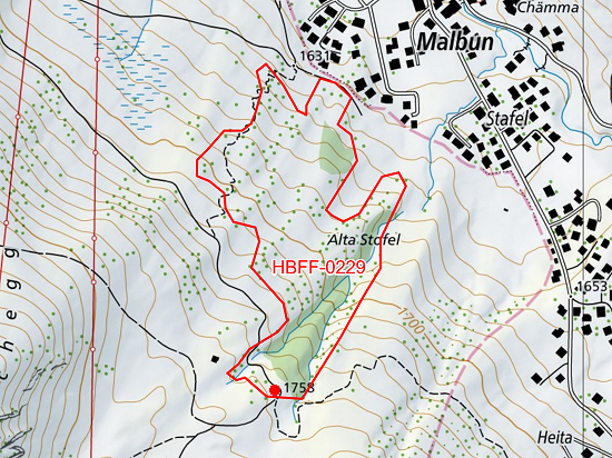 Southwest of Malbun is the Special Forest Reserve Alta Stofel HBFF-0229.
In previous years, I have already walked through this area several times with rather loose forest sands.
Everyone who walks through the Vaduz Täli to Pfälzerhütte comes through the southern end.
And even those who complete the panorama trail around Malbun will also pass by this point.
I used the wide road that leads from the bus station Malbun Zentrum (1600 m) in the direction of Alp Pradamee.
Shortly before the alp, a path branches off at 1705 m towards the Pfälzerhütte.
Using this path, you reach the already mentioned tip of the special forest.
Alternatively, the steeper path leading up the slope in serpentines can be used directly from Malbun.
It also leads partly through the Alta Stoffel, see map on the right.
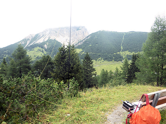 There has been a swing there for a few years.
I set up the station on the bench that had always stood next to it.
The antenna mast attached to one of the low shrubs.
I stretched one antenna wire over the road, the other to a shrub behind the swing.
I could not stand more than 2 hours sitting in one place in the rather mixed weather.
But within this time, 32 QSO's mainly reach 20 m, some also at 40 and 30 m.
For the way back I used the same way.
Day 13: Stachler Wald HBFF-0122 ![]()
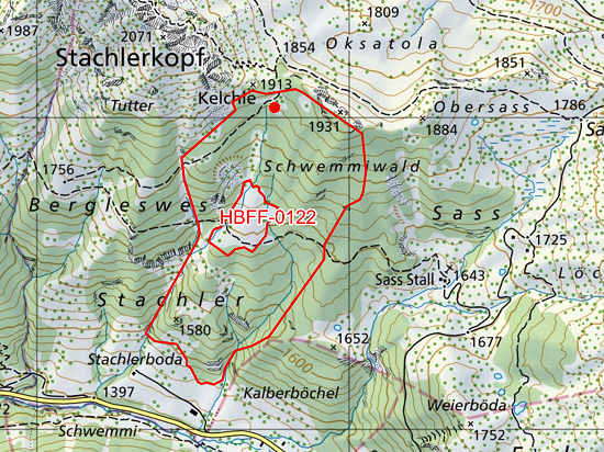 On the southern slope of the Stachlerkopf (2071 m) is the Schutzwald Stachler Wald HBFF-0122.
Only a large free area is exempt from this.
There are 2 hiking trails through the forest, one in the upper area and one further down.
For the shorter, lower route, the bus stop Malbun/Bergbahnen is a good starting point.
After the bridge over the road, the path leads upwards in a wide curve on the hand.
At an altitude of 1677 m, a narrow path branches off to the Sass Stall (1643 m).
When you reach the forest, you are already in the Stachler Forest.
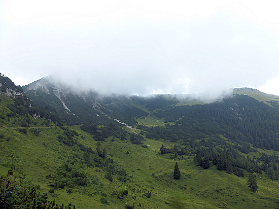 I used the longer, second way.
He led me to a higher altitude area where the surrounding peaks are no longer as shielding.
I started the tour at the bus stop Malbun/Zentrum (1600 m).
There begins a family hiking trail, which leads to the Sassförkle (1785 m) called fork in the road.
The Schönberg is posted at the signpost.
Once you have reached the valley basin, in which the Alp Guschg is also located, there is usually a good view of the Stachlerkopf, the Three Capuchins and the Schönberg.
But the clouds hung so low that day that they remained partially hidden.
 Following the almost flat path at the top of the basin, you reach another fork in the way.
At this point I used the path, which lies between the striking rock needle Kelchle (1913 m) and an adjacent peak (1931 m).
A sign informs you not to enter this area in the period from 15. December to 15. April.
Reason: The entire Stachler Forest is located in this winter rest zone, which extends to the Guschgerbach near Sass Stall.
In the upper part of the Stachler Forest there is a rather loose area with trees.
That's where I set up the station.
As a welcome holder for the mast, I used the pole of the sign.
The antenna could be tensioned in the branches of neighboring trees.
The sun did not break through the whole time and at times it dribbled a bit.
Within 2½ hours I was able to do 39 QSO's mainly at 30 m, but also some at 20 m and one at 40 m.
For the way back I used the same way.
Day 14: Schlosswald HBFF-0123 and Vaduz Castle WCA HB0-00003 ![]()
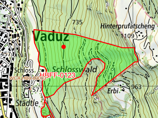 From Hinterprufatscheng to Vaduz Castle stretches the forest reserve Schlosswald HBFF-0123.
It can be reached via a relatively short distance from Vaduz but can also be combined with a slightly longer hike.
According to the link to the Protected Planet on the HBFF page just mentioned, the castle forest also includes the area along the mountain road that leads above Vaduz Castle in the direction of Triesenberg.
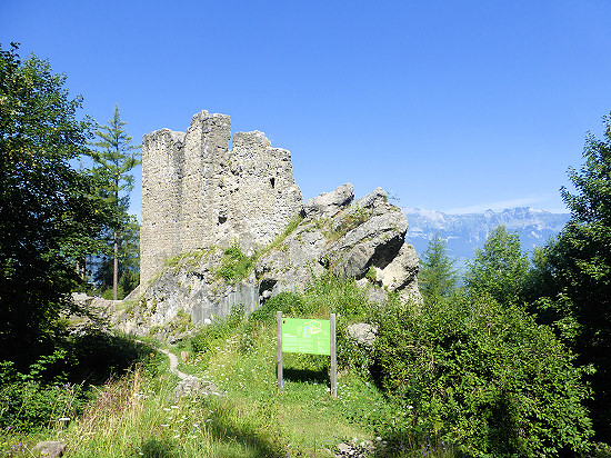 I started at the parking lot Gaflei (1483 m).
The first part above Hinterprufatscheng corresponded to the hike on day 3.
But instead of walking in Hinterprufatscheng (1109 m) to Triesenberg, I used the narrow hiking trail to the wind castle Vaduz (832 m).
The latter is also known as Schalun Castle Ruins and is listed in the WCA list under HB0-00004 "Wildschloss (or Schalun) Castle and Towers Ruins".
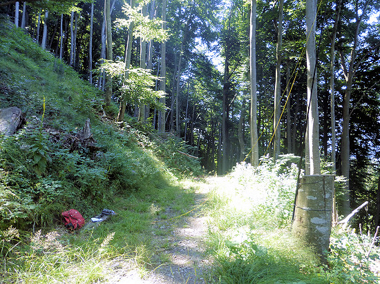 A wide road ends at the Wildschloss.
If you follow him, you end up in Vaduz.
I left this road at the first sharp bend and continued on the partly overgrown path through the Schlosswald.
At least in the lower area of the castle forest there are mainly old and thus large beech trees.
Years ago, a clearing was created by wind breakage.
Since the trees still standing there occasionally let light through, I used this place for the construction of the station.
A large tree stump was used to fasten the antenna mast.
A half tree trunk lying on the other side of the path I used welcome seating.
Within 3¼ hours I was able to reach a total of 52 QSO's at 40, 30 and 20 m.
Since the selected location was less than 500 m from HB0-00003 "Vaduz Castle", the QSO's achieved also count towards the WCA program.
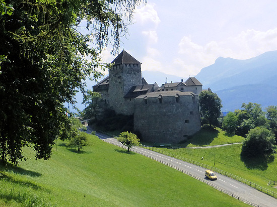
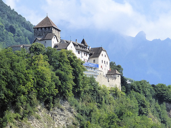 Vaduz Castle could only be guessed from the chosen radio location due to the dense beech forest.
It was much better to see after I had completed the rest of the way through the forest path.
The postcard view of the castle, see right photo, can be found if you use the streets from Letzi to the center of Vaduz.
Letzi is posted on the signposts at the castle.
So you can't miss it.
Day 15: Färchaegg without reference ![]()
Actually, I wanted to experience another nice day on the sunny slope of the Färchaegg and by the way reach a few new radio stations, as already on day 4.
But after I had only reached 2 QSO's at 40 m in ½ hour, the thunderstorm, which was already audible in the headphones, came too close.
Therefore, I quickly dismantled the station set up on the bench there and went back to the house as quickly as possible.
Before there, in the rain after the thunderstorm and with the larger Doublet antenna, I was able to reach a total of 22 QSO's in 2¼ hours mainly on 40 m and 2 QSO's each on 20 and 30 m.
A short break was dinner at the Berggasthaus Matu.

Day 16: Moggawald/Schwarzwald HBFF-0228 ![]()
 Before the end of my holiday I hiked again in the protective forest Moggawald/Schwarzwald HBFF-0228.
I started again at the parking lot Gaflei (1483 m).
Over the meadow below the aussuchtsturm I reached relatively quickly the already known from day 3 way turn.
But contrary to the previous activity, this time I chose a place further up the hand.
From there I could see the rock face with the Fürstensteig between the individual trees.
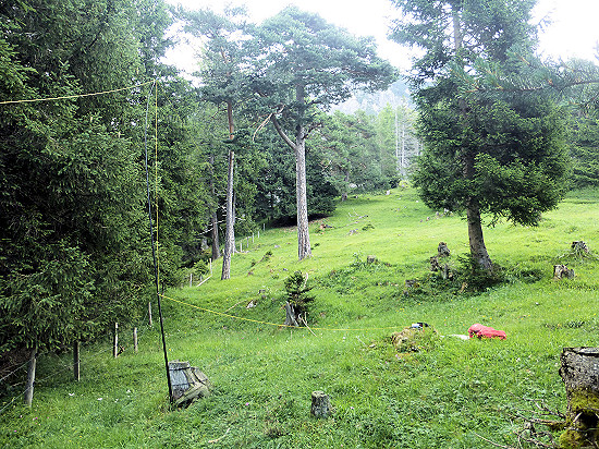 I attached the antenna to a short tree stump.
Nevertheless, the mast did not tip over, as there was hardly any wind blowing.
I placed the station on another stump not far away.
Since there was an ongoing change between light rain showers and full sunshine, I constantly changed clothes at first.
At some point, I got tired of this.
From then on, the rain cape also served me as sun protection.
Within 2½ hours I was able to reach a total of 12 QSO's at 40, 30, 20 m.
This time I did not hike any further on the way back, but headed directly first to the Berggasthaus Matu and later to the accommodation.
Day 17: Station dismantling and departure ![]()
In the early morning I dismantled the Doublet antenna stretched around the house.
For the start of the return journey, I again chose the green buses from LIEmobil, which took me to Feldkirch.
From there I first used regional trains and later the ICE to Berlin, where I arrived late in the evening.
Preparation ![]()
 Every hiking and radio activity requires a certain amount of preparation, although this is expected to be rather small for day trips.
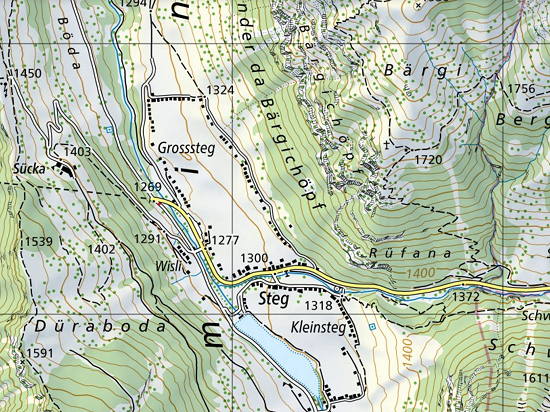
Good maps are available at Swiss Topo, even if Liechtenstein is only listed in the margins.
In my experience, paths that are not marked on this website are also not available, no matter what other pages indicate.
While the website is only accessible online, the "swisstopo" app also makes it possible to orient oneself offline.
The latter is particularly useful if you do not reach a network.
Experience has shown that you still have good reception on mountain ridges and peaks, but in not so deep valleys it can happen that you sit in a dead zone.
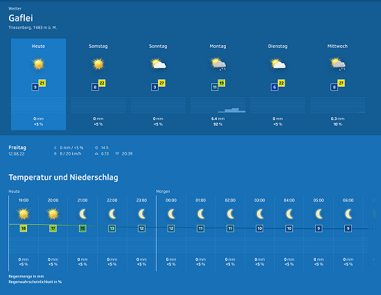 Of course, a good preparation also includes informing yourself about the expected weather.
The weather forecasts prepared by SRF/Meteo can provide a good indication.
Among others,
Balzers (474 m),
Gafadura Hütte (1460 m),
Gaflei (1483 m),
Malbun (1599 m),
Planken (786 m),
Sareis (2003 m)
Schellenberg (626 m),
Steg (1303 m),
Triesenberg (884 m) and
Vaduz (455 m)
can be selected.
In addition, there are hourly subdivisions of forecasts.
SOTA, HBFF and WCA ![]()
Getting active from both SOTA peaks and HBFF areas or near a WCA object is easy because there is no minimum QSO number.
Whether you only achieve 1 QSO or achieve 100 QSO's does not matter to the hunter sitting at home.
All you have to do is load the log into the respective database.
There are specific activity centers in each case.
Their use is not connecting.
But if you are active in their vicinity, the hunters will find you faster.
In addition, it is advisable to announce your own activity in good time in advance on the respective portal.
As a result, the hunters know that someone will be there or there, which significantly increases the number of calls.
For a HBFF area, this can be done on the WWFF webpage.
 Getting a summit valid for the SOTA program recognized as an activator is relatively easy compared to the requirements for HBFF.
You are allowed to stay up to 25 m below the summit and only have to reach 4 QSO's.
In Liechtenstein there are 9 peaks valid for the SOTA program with altitudes between 698 m and 2599 m.
SOTA/QRP Activity centres
CW: 1836, 3560, 7030, 10106/16, 14060, 18096, 21060, 24906/10, 28060 kHz
SSB: 3690, 7090, 10140, 14285, 18130, 21285, 24950, 28360 kHz
 Somewhat more complicated are the rules to get a HBFF area valid as an activator for the national HBFF award.
On the one hand, 51 QSO's (otherwise 100 QSO's) are currently required.
Only if you are active at the same time on a summit valid for SOTA, the required QSO number is reduced to 44.
Quasi as proof of activation, you have to capture the station structure and environment in the photo together with the logbook in ADIF format.
And you should make a note of the GPS coordinates.
In addition, you must be "on air" for at least 2 hours and only activate 2 HBFF areas in one day.
If you do not reach the necessary QSO number, you may continue the activity within 30 days, but do not activate another area in between.
There are currently 36 WWFF areas valid for the HBFF programme in Liechtenstein.
Incidentally, the Swiss Topo map is also used on the HBFF website.
For HBFF areas that are not displayed there as an outline, you can display the outline on Protected Planet via a link given in the left area.
WWFF Activity centres
CW: 3544, 7024, 10124, 14044, 18084, 21044, 24894, 28044 kHz
SSB: 3744, 7144, 14244, 18144, 21244, 24944, 28444 kHz
 It is relatively easy to activate a castle valid for the WCA program.
You only have to be within a radius of 1 km around the castle.
It is even possible to activate more than one lock at a time if they are located a maximum of 1 km from the site.
To be recognized as an activator, a minimum of 50 QSO's are required.
The WCA committee can request photos or videos as evidence if something is unclear.
Since 13.8.2022, there are 5 instead of 4 objects valid for the WCA programme in Liechtenstein.
WCA Activity centres
CW: 3531, 7031, 10121, 14031, 18081, 21031, 24911, 28031 kHz
SSB: 3731, 7131, 14251, 18131, 21251, 24951, 28551 kHz
Station and statistics ![]()
As a radio station I always used an Elecraft KX3 with 5 W transmission power and built-in antenna tuner.
A LiFePo4 battery with 13.2 V/3 Ah was used for the power supply, which enabled sufficiently many hours of radio operation.
On the way I used a double antenna stretched as an Inverted-V.
The building instructions can be found here.
In addition, I used a 6 m GFRP telescopic mast on the way.
"At home" a double antenna with 2 × 24.5 m and 8 m long feedline was used.
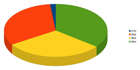
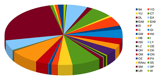 In total, I was able to reach 454 QSO's at 40, 30, 20 and 17 m.
In the process, I get connections to 32 DXCC entities: 9A, CT, DL, EA, EA8, EA9, EI, F, G, GI, GM, HA, HB, I, IS0, LY, LZ, OE, OH, OK, OM, ON, OZ, PA, RAeu, S5, SM, SP, UR, W, YO, YU.
The stations on the other side of the large pond were all located on the east coast.
I was also able to reach 9 HBFF areas and 2 summits counting for the SOTA programme.
Thanks ![]()
A special thank you goes to my friends in Liechtenstein, who welcomed me very warmly as a family member in their house.
In addition, I would like to take this opportunity to thank Monika and Werner Schädler, the operators of the Berggasthauses Matu, for the excellent service and good hospitality.
Even my extra wishes were fulfilled at any time.
 In addition, I would like to thank all the callers who answered my sometimes quite quiet signals.
All those that I could not accommodate in the small pile-ups that I temporarily arise, I hope to be able to record at the next opportunity.
All QSO's are included in the HB0 logbook and in the databases of SOTA, WWFF and WCA.
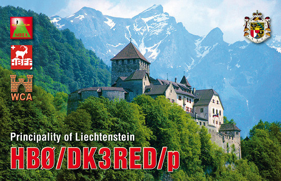
A new QSL card has already been ordered from the QSL shop.
When the cards have arrived from the print shop, I will fill them out as soon as possible and send them via the buraeu.
73/72 de Ingo, DK3RED - Don't forget: the fun is the power!
Addendum from 31.10.2022: All QSL cards were sent today via QSL bureau.