12.3. - 9.7.2022
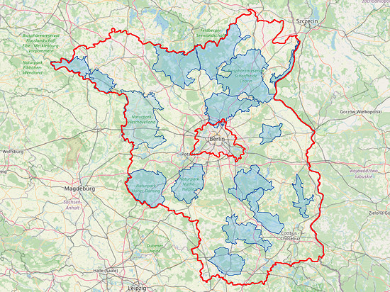 In the federated states of Brandenburg and Berlin, where I live and where I am often on the move, there are a large number of areas, which counts for the DLFF program:
Flora Fauna Habitats, nature conservation and Natura 2000 areas, 1 national park, 3 nature reservates and 11 nature parks.
Currently, 131 of them are already listed in the DLFF list.
Incidentally, there are currently (effective 1.4.2022) 895 valid DLFF areas throughout Germany.
A worthwhile destination is therefore almost always nearby, no matter in which direction you drive.
Since the weather is slowly getting better and the temperature is rising, radio operation outdoors is also possible for a longer period of time.
Therefore, I will try to go to one or the other DLFF area on as many weekends as possible by train, bike and/or on foot.
Strategy, station and logbook ![]()
The list of DLFF areas is available on www.funkatlas.de/dlff/.
In addition, these areas are included in the "Directory" on https://wwff.co.
In addition, the "map"" there shows where these areas are located.
On the map of protected areas in Germany of the Federal Ministry for Nature Conservation (Bundesministeriums für Naturschutz, BfN) you can see the boundaries of the respective DLFF area.
But be careful: Not all areas listed on the BfN webpage are already valid for the DLFF programme.
During the preparation, it is advisable to check with www.cotagroup.org to see if there is a castle nearby.
Even a mountain that counts for www.cqgma.org or www.sota.org.uk can be an additional incentive for activation.
Similarly, an island listed on www.iota-world.org can be the impetus if it is a DLFF area already.
OpenStreetMap offers good maps.
The OsmAnd app based on this can also be used without a connection to the Internet.
As a transceiver I use an Elecraft KX3 with 5 W output power.
Such a multi-band device offers the possibility to avoid a contest or to switch to a band that is more suitable for it.
A self-built, 9.5 m long vertical is used as the antenna, but it only has a single, equally long radial as a counterweight.
Via a 6,9 m long two-wire cable with a velocity factor of 0.82 I can match this antenna with the antenna tuner from 40 to 15 m.
In principle, it is an angled doublet.
Due to the 10 m telescopic mast that I always take with me, I am also independent of guying points.
If necessary, I can also attach the mast to the bicycle I usually take with me.
Most of the time, however, a short pole or shrub can be found to attach the mast to it with rubber strings.
A LiFePo4-Akku battery with 13.2 V/3 Ah provides enough power for a few hours of radio operation.
I log old-fashioned on paper with a pencil.
Ballpoint pens fail their job when the paper has become damp, which can happen quickly outdoors.
Since the QSO data must be entered into the database used by all WWFF/DLFF participants, I use the program Fast Log Entry (FLE) by Bernd Koch, DF3CB, for subsequent logging and output as an ADIF file.
DLFF-0854 - Gollenberg (12.3.2022) ![]()
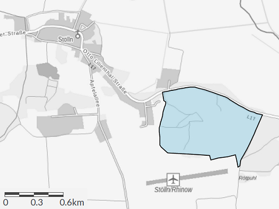 Gollenberg, located in the Nature Park Westhavelland DLFF-0133, has been a protected area since 1996.
However, it is only since the last update at the end of 2021 that the 58 hectare large area has been listed as DLFF-0854 on the DLFF list.
Incidentally, the Gollenberg can also be credited as DA/ND-052 for GMA.
The weather forecast promised for this day plenty of sun, 10 °C and moderate wind with gusts, but only 10 % rain.
Therefore, I took the train to Friesack and from there 17 km by bike to Stölln to the foot of the Gollenberg.
A comfortable cycle path leads to Kleßen, i.e. about half the way.
By the way, in Kleßen there is a castle that counts as BRB-117, DL-04112 for WCA/COTA.
From there you have to change to the L17, which is relatively little used.
The last 700 m to the summit could only be done on foot, as the path was simply too steep for me.
Small note: From the parking lot north of the mountain directly on the L17, only many stairs lead to the monument erected at the crash site on the mountainside.
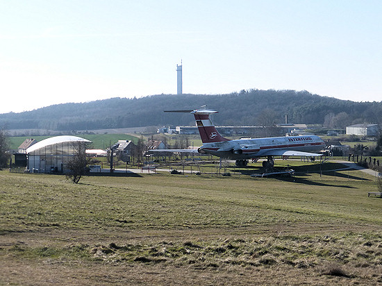 On and around the Gollenberg, a lot revolves around flying.
From the spring of 1894, Otto Lilienthal regularly used the then largely unforested mountain as a starting point for his test flights, before he crashed there 2½ years later and died shortly afterwards.
But even after that, the mountain remained the starting point for gliders and motor pilots.
An airfield still exists today, the oldest in the world.
In addition, there is a decommissioned Ilyushin IL-62 in the Lilienthal-Centrum Stölln.
The mountain in the background of the aircraft is the 96 m high Falkenberg with the telecommunications tower Rhinow.
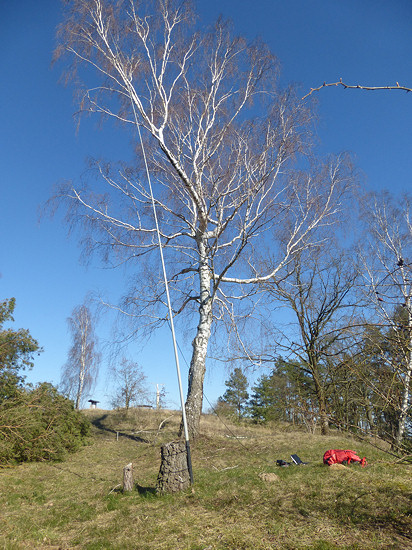 The summit is visited by quite a lot of visitors, not only the aviator park.
Once at the top, I therefore looked for a quiet place a little away from the der wind harp right here.
The telescopic mast with a 10 m wire vertical could be easily attached to a tree stump.
As a counterweight, I use a radial stretched about 2 m above the ground to a fallen tree.
I placed the stationeinen Elecraft KX3 mit 5 W Sendeleistung, on the dry grass floor before I flop oneself next to it.
Since no one answered my CQ calls at 17 m and 20 m, I switched to 30 m and reached the majority of the connections of the day.
The CW range of the 40 m band was almost unusable due to a broadband disturbance similar to a jammer, so I switched again to 20 m.
This time a few connections were made, even if the conditions became noticeably worse.
When at some point no one answered, I dismantled the station much earlier than planned after 1½ hours and 36 QSO's.
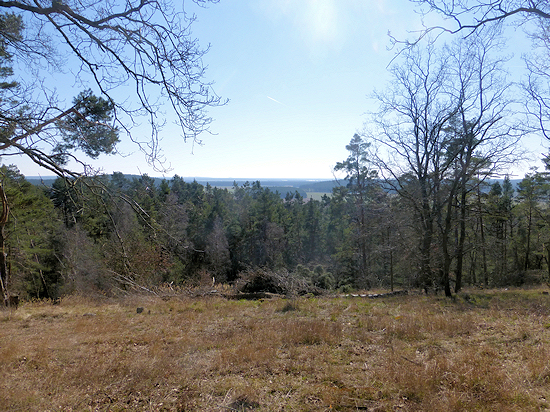 I can only advise every radio amateur not to get off and go home immediately after activation.
Although the 109 m high Gollenberg is nowadays mostly wooded.
But from the summit and a few surrounding vacancies on the mountainside there is an excellent view of the relatively flat Nature Park Westhavelland.
However, even on a clear day, it will not be possible to do more than 40 km, as the Gollenberg only towers over a large part of the surrounding area by 75 to 80 m.

DLFF-0375 - Havelländisches Luch (20.3.2022) ![]()
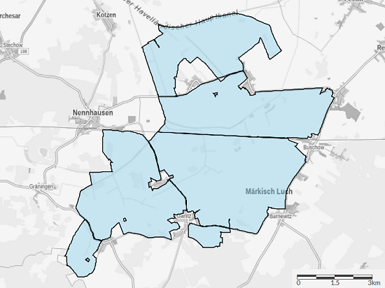 The beginning of spring this year fell on this day and the weather was adequately predicted for this day: sun, 15 °C and only 10 % rain.
As a destination I had chosen the approximately 30000 hectares large Nature Reserve Havelländisches Luch DLFF-0375.
Geographically, this area belongs to the Nature Park Westhavelland DLFF-0133, but it counts separately for the DLFF programme since years.
I started the bicycle ride at the railway Nennhausen.
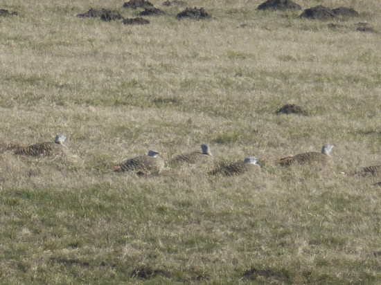 On a trip to the Havelländisches Luch you should definitely take binoculars with you to discover some of the Great Bustards living there.
North of Buckow there is a 30 hectare large fenced area, whose fence protects the birds breeding there from predators (fox, raccoon dog).
This time I was able to make out two groups of about 30 birds in this protected area from the road and with the naked eye, after 4 weeks before none had been seen there.
Nevertheless, I continued to the observation tower 7,5 km from the railway station right here.
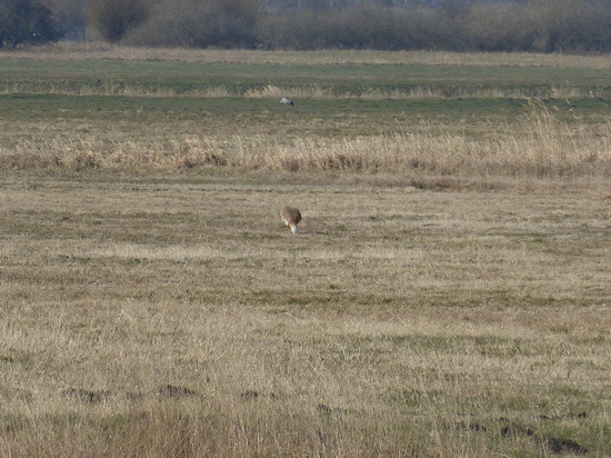 From the visited tower, only about 100 m away, even without binoculars, 36 Great Bustard chickens could be found, which had settled in a long hollow for "sunbathing".
About 1000 m away, another group of about 30 birds could be spotted between two trees, including at least one rooster.
Although this did not show its white, fluffy undersprings, it was still recognizable by the coloration.
Thus, I had already discovered almost 100 of the according to Bird Watch about 140 large flying birds living in the Luch.
Another observation tower can be found right here at the end of a path that starts directly in Garlitz.
On the way back to the road, I was able to discover another rooster over 250 m away, which was eating lonely in a meadow.
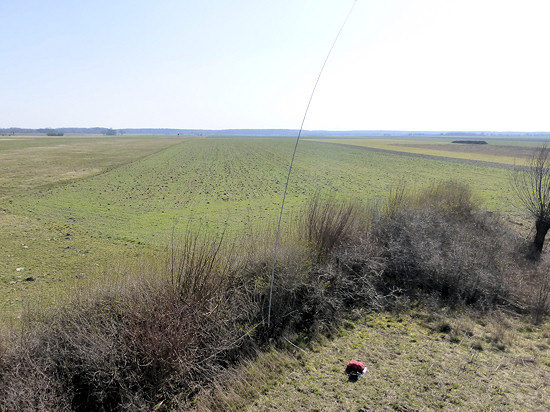 The observation tower is popular, so there is almost always someone there.
The observation platform is therefore not suitable for setting up the station.
I looked for a place protected from the wind by the surrounding hedge.
I tied the mast to the trunk of a larger shrub and stretched the radial acting as a counterweight along the hedge.
After putting the station components together, I sat down next to it on the meadow and in the sun.
In 2½ hours I was able to reach a total of 31 connections on 30 and 17 m.
The received reports confirmed my impression of rather poor propagation conditions was not deceiving.
When there was no one on the tower, I went up again.
However, more birds were not to be discovered.
They are probably more active in the morning and evening.
But then it is at least currently with just over 0 °C too cool for me.
For the 10 km long route to Buschow railway station, I again used the relatively little trafficked roads.
DLFF-0703 - Fauler See (27.3.2022) ![]()
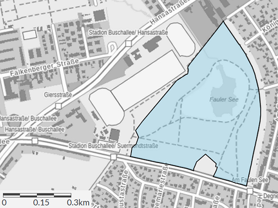 In the middle of Berlin lies in the district of Weißensee between the busy Suermondtstraße, a sports complex on Hansastraße and a residential area with small houses the Nature Reserve Fauler See DLFF-0703.
The nature reserve, which has existed since 1933 and is therefore one of the oldest in Berlin, is 24.2 hectares in size.
Wet meadows and a mixed forest stretch around the approximately 3.6 hectare lake.
According to the Senatsverwaltung, bird conservationists have observed 142 bird species here, 80 of them even regularly.
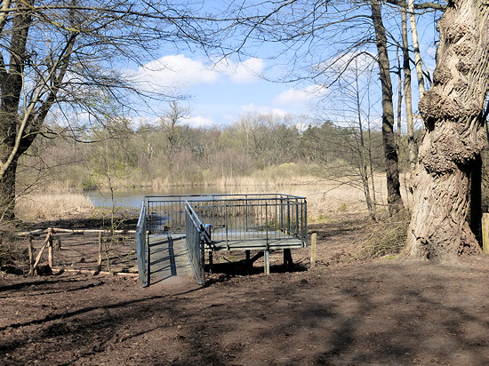 If you add the passage at the forest playground, the nature reserve has 5 entrances.
It has a circular footpath. On the lake side of the trail, a fence prevents visitors from disturbing the birds living and breeding in the wet meadows and in the reed border.
But nature lovers should still get their money's worth, because on the southeast shore a platform about 3 × 4 m in size was built to observe waterfowl.
In addition, most birds can probably be spotted from the path.
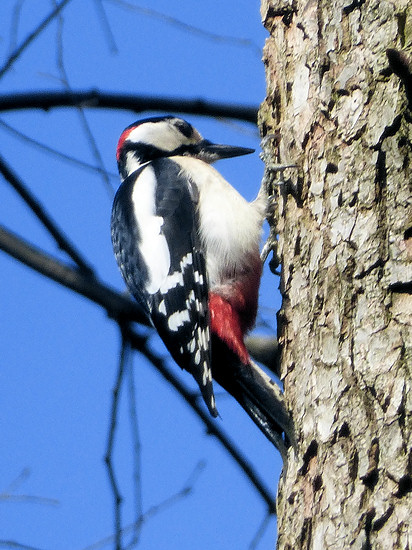 In a Flyer, the Senatsverwaltung gives a small preview of the birds, amphibians and insects found in the nature reserve.
I find it funny that it also contains a map, although this should actually be dispensable in view of the very clear network of paths.
Although this nature reserve has been on the DLFF list for almost 2 years, it seems to have only been activated once and only for 3 QSO's.
That was a reason for me to go to this lake on this day with bus/train and a radio station in my backpack.
Another reason was the weather forecast for the afternoon: sunny, 15 °C and only 10 % rain.
These were good prerequisites for a longer, interesting outdoor activity.
 During a walk around the lake, I was already looking for a possible location for the station.
The above platform is relatively small.
In addition, according to my observations, almost every walker tried to see a few birds from there.
Along the footpath I discovered only one bench on which a walker was already sitting.
And there were more than enough walkers and joggers.
Maybe it was due to the nice weather.
But I suspect that due to the relatively few green areas in the inner districts of Berlin, it will not be deserted there even on cloudy days.
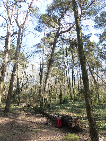
Therefore, I chose a place away from the circular route and relatively close to one of the starting paths right here
There, a jaw that had fallen over years ago offered a welcome surface for construction and sitting.
I attached the telescopic mast to a small trunk.
That was enough, as there was almost no wind.
The propagation conditions were not particularly good, which could be concluded from the surviving reports.
And due to the location in the city, the noise level was relatively high.
Nevertheless, I was able to reach a total of 50 stations from all over Europe and North America within 2½ hours at 20, 30 and 40 m.
When no one answered my CQ calls, I dismantled the station and drove back home.
DLFF-0178 - Kremmener Luch (10.4.2022) ![]()
 For the afternoon 8 °C, partly cloudy sky and 40 % rain were forecast.
This is not my favorite weather, but suitable for activation.
I chose an area that could be reached quickly.
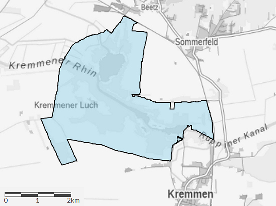
The almost 12 hectare large Kremmener Luch DLFF-0178 is located just a few kilometres from the train station Kremmen.
As a means of transport I used a bicycle again.
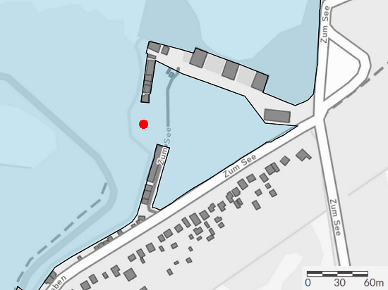 Already at home I had chosen several possible locations.
I did not reach the first one, because behind a few boathouses was at the end of a way declaired as private here finish.
You can't get any further west of the Schlaggraben, even if some online maps show a way there.
The second place here (marked in the map section on the left) is inside the nature reserve, but I did not want to sit between boathouses and parked cars.
Therefore, I drove back to the rural road L19 and after the bridge along the northern bank of the Ruppin Canal.
But even at the end of a muddy path with a some weekend houses, here was also no way in the nature reserve.
 But a narrow ditch stretches parallel to the canal towards the nature reserve.
On the way back, I discovered a place where this ditch could be overcome.
So I got to the nature reserve.
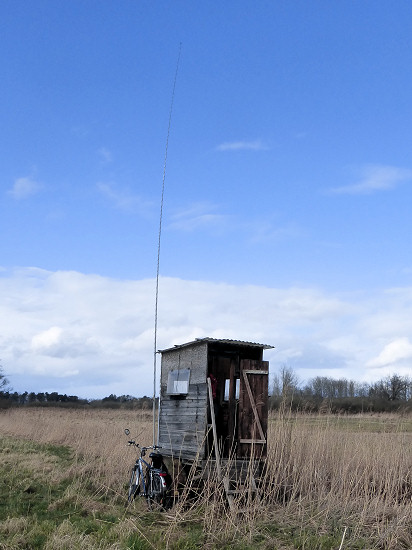
Since the meadow was very humid, I moved into a birdwatching house near another ditch right here.
From the plan to use the steps of the wooden house only to park the station, I refrained after the first rain.
The mast was easy to attach to the drawbar.
The two-wire line I led through the door into the dry.
The house even had an office chair.
And the most important thing: The house offered protection from wind and rain as well as moisture from below.
There was a contest at 40 m.
That's why I changed to 30 m.
In between, I had to switch off the station for 15 minutes because there was a strong crackle in the headphones.
Since I already knew this from a few other activities, the cause was quickly found: It was the antenna that had charged itself in strong winds in the rain.
To protect the receiver input, I connected both wires of the feedline to the ground connection.
Small flashes could be seen.
After another big rain cloud, I dismantled the station and drove back to the train station.
But before that, I was able to reach 23 QSO's in 1¼ hours.
DLFF-0849 - Rheinsberger Rhin and Hellberge (16.4.2022) ![]()
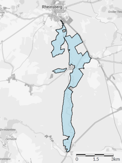 The night was quite cool with 0 °C.
But according to the weather forecast, the temperature should rise to 12 °C, sunny skies should prevail and only 10 % rain.
This promised good conditions for a longer bicycle tour.
As a starting point I chose the train station Rheinsberg (Mark), which is served every 2 hours.
South of Rheinsberg there are extensive pine forests on both sides of the Rhin.
A smaller area around the Hellberge nearby Rheinsberg and the Rhin area to Zippelsförde belong to the Nature Reserve Rheinsberger Rhin and Hellberge DLFF-0849.
On the approximately 13 km long route to Zippelsförde, the river known here as the Rheinsberger Rhin meanders in a narrow mixed forest strip towards the south.
On the western side there is a wide cycle path that leads over long distances along the border of the nature reserve.
In Rheinshagen I changed the side of the river, because there are some of the few bridges there.
The eastern border forms a wide forest path, which can also be easily cycled.
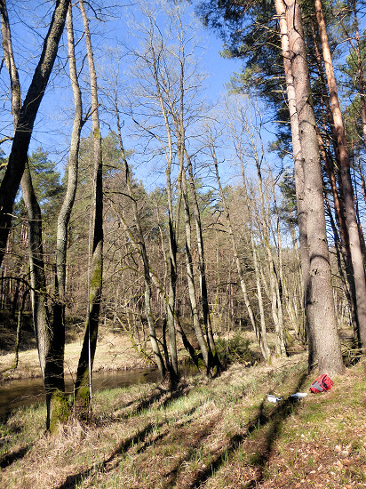 Both from the cycle path on the other side of the river and from the forest path, smaller paths branch off again and again in the direction of the Rhin.
Through one of these ways I got to this place here.
On both sides of the Rhin there is a narrow strip of mixed forest.
I used one of the trees near the shore to fasten the mast, at the foot of a second one I set up the station.
In the meantime, it had become pleasant.
So I was able to reach a total of 53 stations in Europe within 2 hours at 30 and 40 m.
Over 70 % of QSO's were in 40 m.
But at the end of the planned activity time, I had to dismantle the station, because I wanted to go even further and bring another DLFF area into the air.
DLFF-0116 - Stechlin-Ruppiner Land (16.4.2022) ![]()
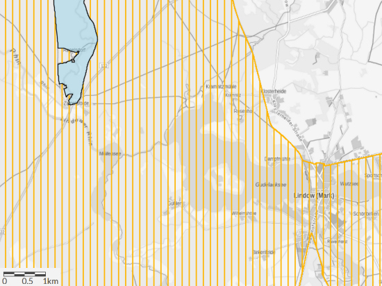 At the southern end of the Nature Reserve Rheinsberger Rhin and Hellberge DLFF-0849 lies Zippelsförde.
However, a large part of the forests around Zippelsförde belongs to the Nature Park Stechlin-Ruppiner Land.
Therefore, on the 8 km long way to Lindow (Mark) station, the destination of the bicycle tour, I looked for a suitable place for a break and an activation of the DLFF-0116.
From the buildings known as Lietze near the rural road L19, an almost straight path leads to Kramnitz on the northern shore of Lake Gudelack.
I turned right directly after the last house onto a wide forest path.
This winds its way between the Nördlicher Kleiner Möllensee and the Teufelssee to the Gudelacksee.
This must have been a main path in the past, because the one on one side of the path there are very old trees in a row.

 At the mouth of the Lindow Rhin there is one of the few bridges in the area.
In addition, there is a wooden rest area right here next to the Gühlenbrücke.
There I set up the station again.
Within 1½ hours I was able to reach a total of 28 QSO's at 40, 30 and 20 m, with only one QSO at 20 m.
There was a strong northeast wind blowing over the lake, which was still quite cool despite the sunshine due to the low water temperature.
This wind, which over time led to clammy fingers, moved me to dismantle the station in the end.
From the bridge it is only about 1,5 km to Gühlen.
There begins a road that isn't hardly used by cars.
Parallel to it there is a bicycle path.
Arriving at the rural road L19, you reach Lindow (Mark) station on the right after about 400 m, the town centre is on the left.
Trains to Löwenberg and Berlin depart every 2 hours.
DLFF-0511 - Gülper See (18.4.2022) ![]()
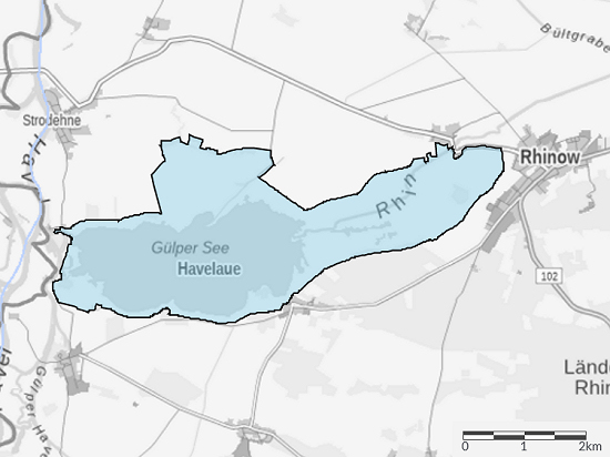 Only partially cloudy with up to 16 °C and only weak wind promised good conditions for another bicycke tour.
As destination I had chosen the Nature Reserve Gülper See DLFF-0511.
The 970 hectare large area is located in the Nature Park Westhavelland DLFF-0133, but has been a separate area for the DLFF programme for several years.
This time I chose the railway station Breddin as my starting point.
On the 21 km long way I headed for Kümmernitz and then Damerow on roads with little traffic.
From there I used partly concrete ways in the direction of the river Dosse.
After the only bridge over the Dosse, which can be seen far and wide, I initially drove on a smooth concrete way and later on a road to the rural road L17.
1,5 km further east, a concrete way branches off, which leads to the pumping station on the edge of the nature reserve.
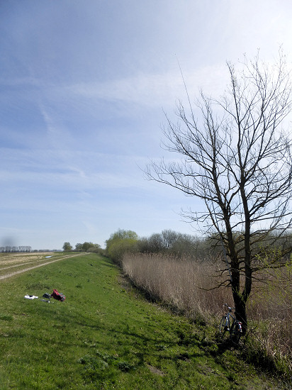 The 660 hectare large lake is crossed by the river Rhin and has a dense, wide reed belt.
Only at the weir there is direct access to the lake shore.
On the northern shore, a wetland also belongs to the nature reserve, through which the dike enclosing the entire lake leads.
On its slope I set up my station right here.
A dead tree on the edge of the reed belt, which could only be reached with dry feet, served to fasten the mast.
I attached the mast as far up to the trunk as possible by means of a rubber band.
Thus, the radial could be stretched almost horizontally to the dike crown.
Sitting comfortably on the meadow in the sun, I was able to reach in 2 hours on 20, 30 and 40 m a total of 53 connections.
Disturbing was the jammer at 40 m, which made the range from 7024 kHz almost useless.

From the site of the station, I could only see the lake as a narrow strip, even after climbing the top of the dike.
The reeds were simply too high.
At the dike section leading towards the weir, however, there are several viewpoints from which this is better achieved.
For the slightly longer way back with 22 km I chose the road from the weir to Strodehne, which took me back to Scheunstelle.
From there I used the already known path to the railway station Breddin.
DLFF-0116 - Stechlin-Ruppiner Land (23.4.2022) ![]()
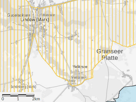 The weather forecast initially promised sunny and partly cloudy skies, up to 16°C and a 10 to 30 % increasing probability of rain.
There are quite good conditions for a longer bicycle tour.
Therefore, in addition to some provisions, I also packed the radio station into my backpack, pumped some air into the tires of the bicyle and took the train to Lindow (Mark) station. As a destination, I had chosen a new DLFF area for the afternoon.
Since the path from the station led through a part of the Nature Park Stechlin-Ruppiner Land DLFF-0116, it made sense to set up the radio station during a short rest.
From the train station I drove first to the center and then along the southern shore of the Wutzsee.
Among other things, there is a path on top of the 10 to 15 m high bank slope.
Along this path and also directly on the shore you will find benches that invite you to set up the station.
However, the weak north wind, which only blows at 10 km/h (2 Bft), thwarted this project at 6 °C.
Therefore, I left the Wutzsee and headed for the municipality of Strubensee with its two lakes.
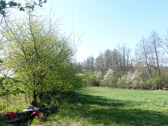 I could not find a path leading to the Kleiner Strubensee.
The Großer Strubensee is completely surrounded by a wide reed belt and partly by trees.
I found a beautiful place lying in the sun and protected from the wind right here.
On a fallen and slowly rotting tree trunk I built the station, as the grass of the meadow was still wetted by dew.
The telescopic mast was attached to one of the low hawthorn trees.
During the break, I was able to reach 20 connections at 30 m within one hour.

From the municipality of Strubensee in the direction of Glambeck, a straight, unpaved road leads in a narrow strip of trees.
The road leading to Seebeck after a total of 6,5 km forms the southeastern border of the nature park.
DLFF-0181 - Harenzacken (23.4.2022) ![]()
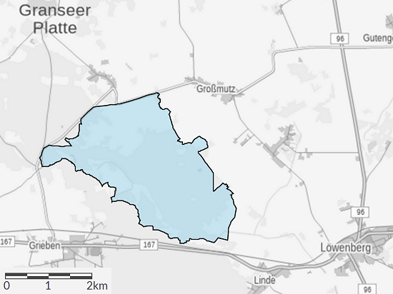 After another 3 km on a narrow, quiet asphalt road to and through the municipality of Glambeck, I reached the edge of the intended destination behind the small village.
The Nature Reserve Harenzacken DLFF-0181 is 823 hectares in size.
According to Wikipedia, the area was only declared a nature reserve in 2003 and is a large wet forest complex.
 On the forest path I chose, about 3,5 km long, I crossed some moats.
In the forest area through there is very extensive forestry work.
But I didn't want to settle in a cleared forest.
Therefore, I first chose the place right here to set up the station, which is about 7 to 8 m above the neighboring meadow.
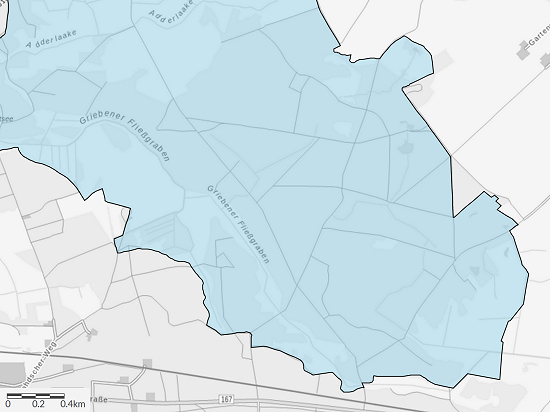
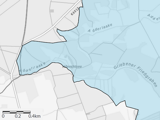
Contrary to the linked representation on OpenStreetMap, according to the map of the BfN (screenshot on the left), the meadows and ditches on the southwest border still belong to the nature reserve.
Well on this map you can also see the almost straight, continuous forest path.
 In the chosen place there are large larches.
I attached the telescopic mast to one of these trees.
And I placed the station on an old tree trunk and myself next to it.
Even though a few clouds increasingly passed through, it remained rain-free.
The rather poor radio conditions of the morning were still present.
In 2¾ hours I could only reach a total of 38 QSO's at 20 and 30 m.
After a total of 13 km I reached the federal road B167 and followed it on the shortest, but still 7 km long way to the railway station Löwenberg.
Parallel to the busy road, there is a cycle path that leads through the village in the area of the bypassed municipality of Linde.
But for the next activation of this nature reserve, I will look for another way for the last kilometers to a train station.
The route chosen on this day from Lindow (Mark) to Löwenberg was a total of 20 km long.
DLFF-0133 - Westhavelland (1.5.2022) ![]()
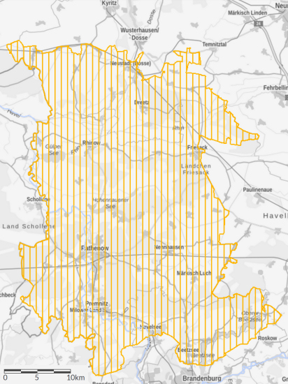 I have already been on the road several times with the bicycle in the 1315 km² large Nature Park Westhavelland DLFF-0133.
Sometimes I also had a radio station in my backpack.
So far, I have often been on my way to one or the other DLFF area.
But this time I had chosen the municipality of Kleßen in the nature park as my destination.
The weather forecast had predicted 14 °C for the afternoon with overcast skies and light winds of 5 km/h (1 to 2 Bft) from the northeast.
And it should only rain 40 % likely.
So let's go!
This time I had chosen the railway station Friesack (Mark) as the starting point of the bicycle tour.
From there, a 2 km long road with a separate bicycle path leads to the town of the same name.
Once there, I turned off in the center onto the rural road L19.
Parallel to this little-used road, there is also a paved bicycle path, some of which even leads through the forest.
After about 9 km I reached the municipality of Kleßen.
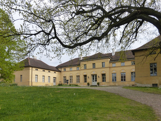 For some years now, the COTA Group has been organising the German Castle Day on 1 May.
From the DL-WCA list, which now comprises more than 5000 entries, I had chosen Kleßen Castle (DL-04112, BRB-117) located in Kleßen.
Precisely because you may be up to 1000 m away from the listed object with such an activation, there are usually several places "in the countryside" for setting up a radio station.
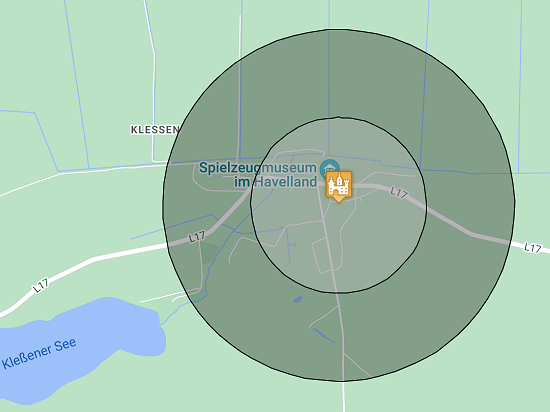 In Kleßen there is, among other things, directly at the castle the relatively small estate garden (4 € admission, key available at the Toy Museum).
In the direction of Lake Kleßen, about 400 m from the castle, lies the much larger and freely accessible English Garden.
Further in the same direction there is even a Mountain Weinberg about 900 m from the castle.
Although it is 67 m high, it is only 26 m higher over the surrounding area.
Only the 52-hectare Lake Kleßen is 1200 m away as the crow flies.
Its shore is therefore not usable for WCA/COTA activation as a construction site.
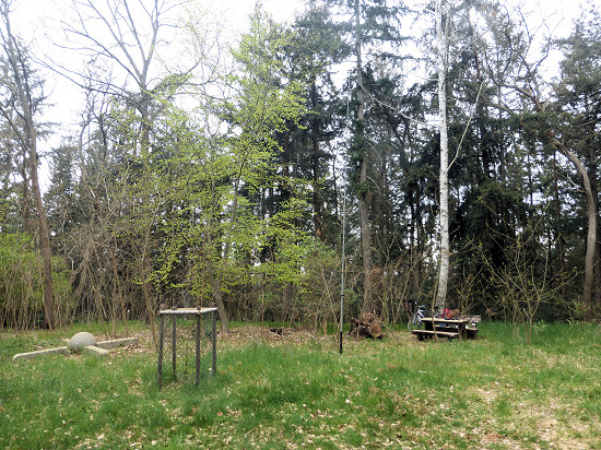 First I drove to the English Garden, but it turned out, this is a normal forest.
According to an information sign, the garden has been feral since the 19. century.
Therefore, I chose the Weinberg.
Its summit is completely wooded and the paths up are quite overgrown.
But at the top there is even a summit cross in the form of a wind rose.
I used the table and the bench right here to set up the station.
At 30 m there were severe crackling disorders.
And at 20 and 40 m there were contests.
So within 3½ hours I could only reach 44 QSO's at 20, 30 and 40 m.
Among them were some QSO's on other castle activatiors at 40 m.
If you have time, you should visit the Toy Museum in Havelland.
It is located directly on the rural road L19 in the immediate vicinity of the church.
Unfortunately, both the Café im Gutsgarten and the Museum Café had closed for the well-known reasons.
Therefore, I pedaled again and made the way back to the railway station Friesack (Mark).
DLFF-0181 - Harenzacken (8.5.2022) ![]()
 The weather forecast was up to 18 °C, consistently sunny, weak to moderate north winds and only 10 % rain.
According to this prediction, it did not keep me at home.
As a starting point for the bicycle tour I used the train station Lindow (Mark).
First I headed over a small road to the community of Seebeck at the southern end of the Vielitzsee.
In front of there I use forest paths that lead to the western tip of the Nature Reserve Harenzacken DLFF-0181.
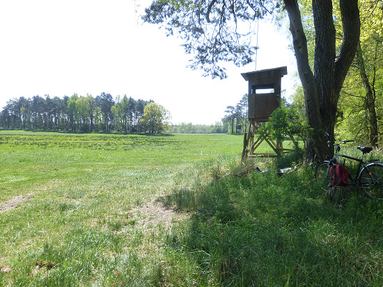 There lies the relatively small Albrechtsee, which has a swampy shore.
A little further on there is a clearing at the edge of the forest, which allows the view of a meadow.
Right here I set up the station next to a high seat.
The latter was used to fasten the telescopic mast.
I put the transceiver in the shade of an old oak tree.
In 1¾ hours I was able to do a total of 24 QSO's on 30 and 40 m.
When no one answered my CQ calls for a long time, I dismantled the station and drove on.
Crossing the community of Grieben I reached the Rüthnicker Heide.
This is an approximately 80 km² large forest area with some heath-like areas, through which many mostly straight forest paths lead.
I initially used a path called "Siedlung II" and turned off about the middle of the area onto the "Mutzer Gestell" leading to Beetz.
The chosen route between Lindow (Mark) and Beetz-Sommerfeld stations is 27 km long.
But I first drove past the train station, because I wanted to go to another DLFF area.
DLFF-0178 - Kremmener Luch (8.5.2022) ![]()
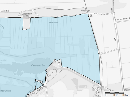 Just a few kilometres southwest of the railway station Beetz-Sommerfeld is the Kremmener Luch DLFF-0178.
It was a good idea for a little detour.
I first headed for a place near the railway line in the direction of Kremmen.
There are high seats and houses for bird watching on the meadow.
But this time the pasture was already used - by bulls.
Since I didn't want to compete with them to find out who would reach the saving high seat first, I drove on.
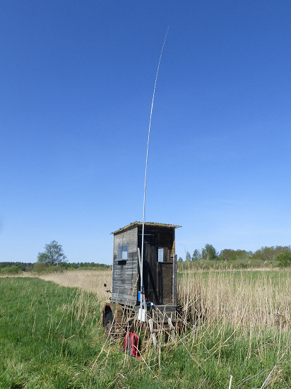 I had already used the bird watching house here once.
But even here animals were present, this time in the form of wasps.
They began to build several nests in the house.
In order not to get any stitches, I closed the door again and set up the station on the steps of the wooden house.
Every now and then a wasp flew around the corner, but everyone left me alone.
In a ¾ hour I was able to reach 15 QSO's at 30 and 40 m.
Since the distance to the railway station Kremmen was a bit shorter as to the one in Beetz-Sommerfeld and also the wind blew in this direction, I drove there with tailwind.
This little detour was 8 km long.
DLFF-0800 - Glieningmoor (15.5.2022) ![]()
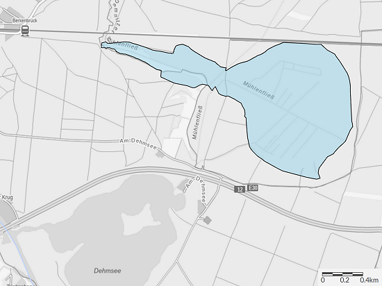 South of the railway line from Berlin to Frankfurt (Oder) and north of the motorway A12 lies between Briesen (Mark) and Fürstenwalde/Spree the Nature Reserve Glieningmoor DLFF-0800.
It is 151 hectares in size and is divided into the eponymous moor and a tip in which a floodplain forrest prevails.
The eastern end of this tip is only about 800 m from the railway station of the municipality of Berkenbrück.
In addition, the the entire area is only 2,5 km long and a maximum of 1,3 km wide.
Therefore, this time I dont't use the bicycle and put on the hiking boots.
Weather forecast: sunny, 22 °C, weak wind
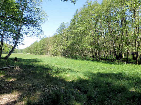 The entire area is crisscrossed by ditches.
They were created to obtain pasture land or peat in the area of the almost oval bog.
First I headed for this place here.
There is a large meadow on the edge of a floodplain forest.
On some maps it was marked that the Demnitzer Mühlenfließ can be crossed there to continue in the direction of the railway tracks.
But I have not discovered a place over the flow, which is several meters wide at this point.
Nevertheless, this place is suitable for the construction of the station, because the nature reserve includes not only the meadow but also the forest adjacent to the south.
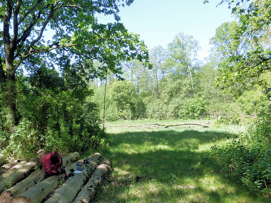 But I walked on, first to the south towards the motorway and after crossing the Demnitzer Mühlenfließ again to the north.
On some maps a small pond is drawn near this point here.
However, there was nothing left to see - the pond seems to have dried up.
On the map of OpenStreetMap only the already mentioned flow is listed.
The ditch, which once drained the moor and which is located a few meters away, has not carried any water for years.
At least that's what the trees and shrubs growing in the ditch reveal.
There are felled trees along the way.
I built the station on a pile of them.
This time I used the shortened and lighter telescopic mast with a Doublet antenna stretched as inverted-V and attached to a lilac bush.
Within 2 hours I was able to reach a total of 50 QSO's at 30 and 40 m.
To prevent the mosquitoes from sucking me out completely, I dismantled the station and continued hiking.

I made another detour to the Dehmsee.
The Demnitzer Mühlenfließ is the only tributary of this lake.
The Dehmsee flows at its southern end into the Spree, which is only a few hundred meters away.
At the headland here there is a way to get directly to the lake shore.
For the way back to the railway station I used the route, which is cut out as a hiking trail.
DLFF-0854 - Gollenberg (22.5.2022) ![]()
The weekend started with storm and Saturday was windy and rainy.
But the weather forecast promised for Sunday 20 °C with initially overcast later partly cloudy sky, only weak northwest wind (10 km/h, 2 Bft) and to 30 % decreasing rain probability.
So I get out the biclycle and go!
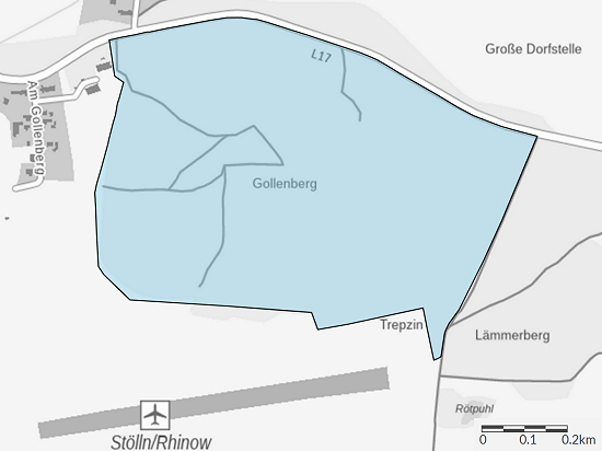 The Nature Reserve Gollenberg DLFF-0854 can be reached the fastest from Neustadt (Dosse) railway station via the federal road B102 and the municipality of Rhinow.
The path is quieter and almost the same length if you leave the B102 after 1,5 km in the district of K&oumLritz and use the highway L141 to Dreetz.
From there I used a small road, which at the end meets the L17 road north of the nature reserve.
At the parking lot at the Lilienthal-Centrum Stölln I got off my bicycle and pushed it.
The last 650 m through the forest are sometimes 12 % steep and in places very bumpy.
The chosen route was a total of 17 km long.
The 109 m high summit in the 58-hectare nature reserve also counts as DA/ND-052 for GMA.
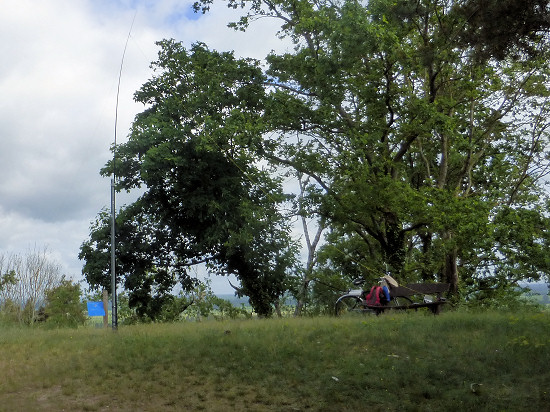 For the construction of the station I chose the viewpoint here, which is a bit away from the summit.
On it there is a bench that is no longer quite fixed, but so I did not have to sit down on the meadow.
The telescopic mast could be attached to an existing metal pole.
The feed line of the re-inserted Doublet antenna, which was stretched as an inverted V, reached all the way to the bank.
Within 2¼ hours I was able to reach at 40, 30 and 20 m a total of 45 QSO's to stations all over Europe.
Since I wanted to go to another DLFF area, I could no longer reach all callers.
DLFF-0133 - Westhavelland (22.5.2022) ![]()
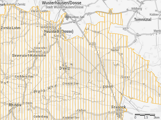 The path from Gollenberg to Neustadt (Dosse) always leads through the Nature Park Westhavelland DLFF-0133.
A good reason to briefly set up the station again.
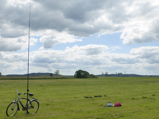 I had already chosen the place here at home.
There is a weir on the Rhin, which has been converted into a canal here.
But this place had already been chosen by some anglers.
The other shore areas near the bridge are densely overgrown.
Since I did not want to sit on the path on the top of the dike, I drove a bit further.
On a recently mown pasture I built the station here.
This time I used my bicycle as a guying point for the mast.
With a view of Gollenberg 5 km away as the crow flies, only 7 QSO were achieved at 40 and 30 m in a ¾ hour.
The preserved, rather bad reports ultimately burden me with dismantling the station.
For the way back to the railway station Neustadt (Dosse) I used the same way.
DLFF-0856 - Ruhlsdorfer Bruch (26.5.2022) ![]()
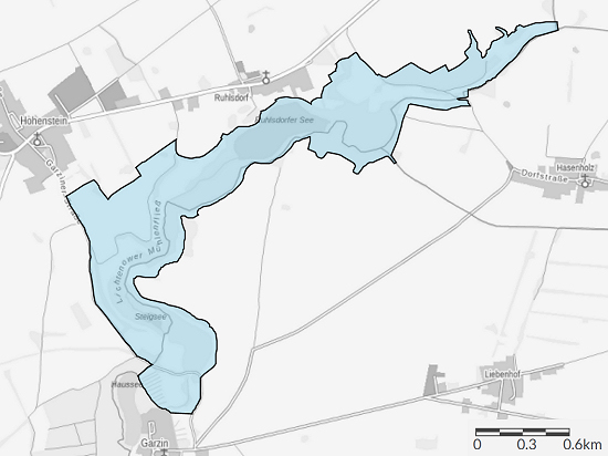 Since the weather was supposed to be relatively humid at the weekend, I used the official holiday within the week for a bike ride - like so many others.
However, my goal was to activate the Nature Reserve Ruhlsdorfer Bruch DLFF-0856, which was only recently included in the DLFF list.
It is located west of the city Strausberg.
As a starting point I used the railway station Strausberg (Stadt), which can even be reached with the Berlin S-Bahn.
From there, it is only about 8 km on the country road L34 to the district of Ruhlsdorf, which belongs to Strausberg.

As the term "Bruch" suggested, it is a swamp or moor landscape.
Already at home I had chosen a few possible assembly sites an the north and west side, which I looked at one after the other.
Option 1: In the northern area there is a signposted path as a private path.
There are opportunities to set up the radio station at one of the meadows or the clearing almost at the end of the Bruch.
Option 2: Birdwatching towers stand inside the Bruch and around the Bruch at relatively short intervals.
From this tower here, located at the edge of a pasture, a part of the Bruch could be overlooked.
But this location offered no windbreak.
Option 3: In the middle of Ruhlsdorf, next to the Findlingshof Strausberg, a path leads down to almost the lake.
But at this point here there are only reeds and a few trees in addition to a few moored boats.
The free area on the right hand side is already part of the neighbouring property and is not part of the nature reserve.
In addition, there was just a barbecue there.
Option 4: On the country road L34, between Ruhlsdorf and Hohenstein, a road branches off directly at an old bus stop, which is initially heavily overgrown.
Later, it runs along the upper edge between the agricultural land and the lower wetland.
And this path is part of the nature reserve.
Unfortunately, the relatively strong wind of magnitude 5 with gusts up to 7 Bft prevented me from settling there.
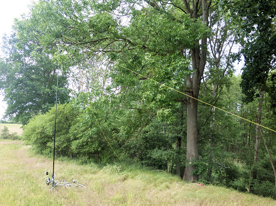 In the end, I found a place here at the end of a pasture that suited me.
This place is quite close to the Lichtenower Mühlenfließ and the Steigsee.
There are large oak trees that offered me the desired windbreak.
The lowest branches were too high for me and the small shrubs turned out not to be stable enough.
So I attached the mast to the handlebars of the bicycle lying on the ground.
Since I had spent a lot of time looking for a place, the activation was quite short.
Nevertheless, I get 47 QSO's at 40 m within just under 1¼ hours.
For the way back I used from Hohenstein again the country road L34 to the railway station Strausberg (Stadt).
In view of the relatively strong headwind, the slightly longer path leading partly through forests via Garzau and Rehfelde to the railway station Hegermühle would have been more suitable.
Weather conditions: 21 °C, partly cloudy, brisk westerly wind with 30 km/h (5 Bft), in gusts with 55 km/h (7 Bft), precipitation probability 40 %
DLFF-0848 - Horstfelder- und Hechtsee (4.6.2022) ![]()
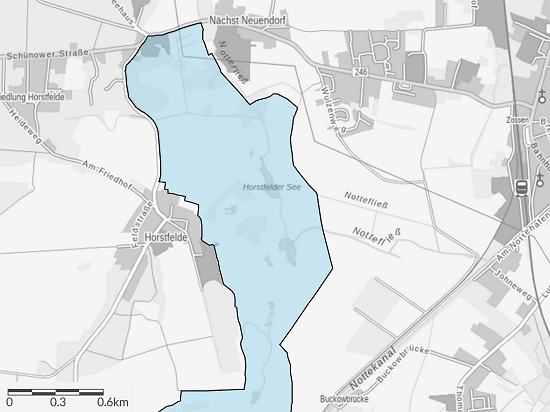 West of Zossen is the Nature Reserve Horstfelder- und Hechtsee DLFF-0848.
The 248 hectare large area mainly includes low moor areas.
Areas that can be reached at dry foot are therefore only a few available.
But there are.
In the northwest, there are two larger areas that are not shown as "wet" on the maps.
In the southeast I found another area on the map.
But I didn't look at it in terms of suitability.
On the rest grows more or less a lot of reedbed interrupted by some small woody islands.
Hidden in the reed beds is the Horstfelder See in the north, which consists of two parts, and in the south the largely silted up Hechtsee.
This time I chose Zossen railway station as my starting point.
Since the destination was so close, my bicycle stayed at home.
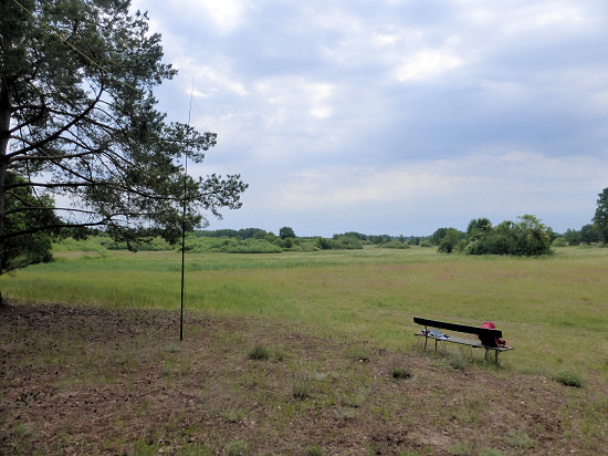 Along the forest between the districts of Nächst Neuendorf and Siedlung Horstfelde there is a forrest path on the side facing away from the road.
The adjacent pasture, possibly also usable, was highly overgrown with grasses.
So I chose the path, because it can also be used to reach a mobil hunting stand and a birdwatching tower, as I only realized on site.
However, I settled in this place here.
At this point is a bench that has seen better days before.
But it was enough for me to set up the station.
I attached the mast to a low-growing pine branch.
Sitting comfortably in the sun, only 2 QSO's came to the logbook at 17 m in the first hour.
30 m was unsuccessful.
And on 40 and 20 m ran a contest.
So I took a longer break and a closer look at the immediate surroundings.

Then I tried again at 20 m, but this only brought in another QSO.
But when I switched to 40 m, many contesters were probably sitting at the lunch table.
Anyway, the hustle and bustle was less strong and I was able to find a vacancy at 7024 kHz and called CQ.
The rush that began after the first QSO's was huge.
Within just under %frac34; hour I reached 32 QSO's.
There would certainly have been more, but fishing a call sign out of the brood always took a while.
As quickly as the small pile-up was created, so quickly it disappeared again.
As a result, there was also time for a longer QSO with another QRP station in the PA.
When at some point no one answered, I changed again to 30 m and was able to reach a few more QSO.
In 2½ hours of pure time at the station, a total of 39 QSO's on 40, 30, 20 and 17 m were entered into the logbook.
I made the way back to the railway station on the same path, taking a small shortcut on a road through the forest.
The route from the station was just under 4 km long, the way back 500 m shorter.
Weather: partly cloudy, 24 °C, moderate northeast wind with 15 km/h (2-3 Bft) and 40 % chance of rain
DLFF-0853 - Salveytal (12.6.2022) ![]()
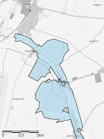 The Nature Reserve Salveytal DLFF-0853 stretches between the municipality of Tantow and the town of Gartz (Oder).
It is 382 hectares in size and includes three mill ponds and the Geesower Bach in addition to the eponymous Salveybach.
The Salveybach flows behind Gartz (Oder) into the Westoder, which forms the state border with Poland.
The northern end of the nature reserve is just 1 km from the railway station Tantow.
Therefore, my bicycle stayed back home.
The Salveybach flows in a strip about 50 m wide, in which there are mainly reeds and alders standing on swampy ground.
So you can only get directly to its shore in a few places.
However, the nature reserve also includes some agricultural land and in the north there are three larger pieces of forest.
First I headed for the forest on the eastern side of the brook.
But neither stopping nor setting up the station was to be considered.
Due to the nearby brook, there were countless mosquitoes.
So keep going!
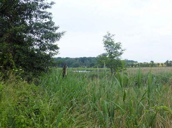 On the eastern side of the brook, a path is noted on some maps between the forest and the mill.
But this path no longer exists.
Nevertheless, I made my way through to the mill in the woody strip between the edge of a grain field and the reed belt on the brook.
However, I can not recommend this, because there are more convenient ways.
Salvey-Mühle 3 (mill) is one of several.
The number 2 is about 1,5 km down the stream and the number 1 again about 1,5 km further.
The latter, however, is only a ruin.
At the mill I crossed the Salveybach and headed for the next piece of forest on the west side.
Although there were fewer mosquitoes, there were still too many to stay longer in one place.
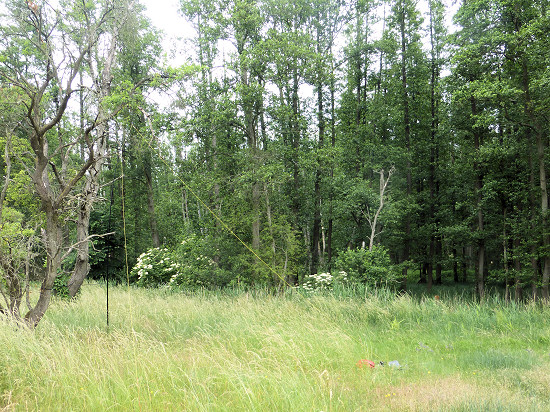 I had chosen the mill as a turning point.
For the way back, two paths can be used: the old railway embankment with gravel and the Geesower Weg with cobblestone plaster.
I first used the railway embankment and switched to the road after reaching the next edge of the forest.
Between the mill and Tantow Ausbau there is a narrow, long grain field, which is part of the nature reserve.
It is located between brook and forest.
At its end I settled down on a high overgrown meadow strip and built the station here.
Although the swampy alder forest was not far away, no mosquito bothered me sitting in the sun.
Within 2 hours I was able to reach a total of 47 QSO's, with the first hour being relatively quiet.
A QSO was achieved at 40 m, the rest was at 30 m.
The line between Salvey-Mühle 3 and Tantow railway station is less than 3 km long.
If you want, you can also cover the entire way from Tantow to Gartz (Oder) on the old railway embankment.
The one-way route is only 8 km long.
In addition, there is a route designated as a bicycle path, which already branches off in Tantow and initially leads over fields to Geesow.
From there, the path leads along the Geesower Bach to Gartz (Oder).
As already written: The Geesower Bach is also part of the nature reserve Salveytal.
This route is about 9 km long.
Weather: initially partly cloudy later sunny, 25 °C, moderate westerly wind with 15 km/h (3 Bft), 30 % chance of rain but no significant precipitation
DLFF-0848 - Horstfelder- und Hechtsee (18.6.2022) ![]()
 The evening before, I had already prepared everything for the activation of a DLFF area a little further away from where I live.
Early in the morning I checked the train webpage again to see if the planned trains would be on time.
I was amazed when I realized that at least all trains to their destination would be cancelled throughout the weekend.
Unfortunately, there are no buses running there during this time.
And completing the required distance by bicycle was too long in view of the predicted heat.
What now?
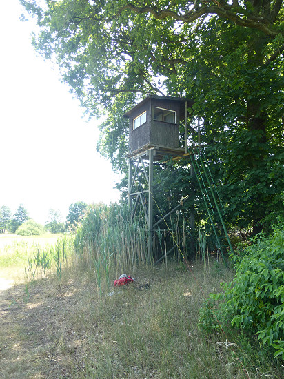 As an alternative, I chose the Nature Reserve Horstfelder- und Hechtsee DLFF-0848.
Although I had already activated this DLFF area 2 weeks before, there were still some QSO's missing up to 44.
In addition, it can be reached relatively well on foot.
As a starting point I chose the railway station Zossen.
Since the temperature should rise to 35 °C during the day, I looked for a shady spot in the north for myself and the transceiver.
At the bird observation tower right here I set up the station.
In the house of the tower there are also two chairs.
But I sat down on the ground at the edge of the forest, because there was at least one more breeze there.
In just under 1 hour, I could reach a total of 12 connections at 17 and 30 m.
Weather: sunny, up to 35 °C, lively west wind with 25 km/h (4 Bft)
DLFF-0850 - Weesower Luch (26.6.2022) ![]()
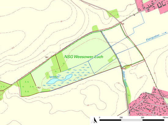 In the immediate vicinity of the small town of Werneuchen stretches the 56-hectare Nature Reserve Weesower Luch DLFF-0850.
Among other things, the purpose of protection stated here was "the conservation and development of the area as a location for rare plant communities threatened in their existence, in particular wet meadows, sedge reeds, reed beds and small bodies of water".
The nature reserve is located northwest of Werneuchen.
For example, you can reach its border from Werneuchen railway station via a road through the district of Amselhain and continue on a dirt road after almost 2 km.
Already at home, I had selected a few possible locations for the station based on the map on page 22 of the action plan.
At this point here are a few trees, but they offered little shade.
The high seat here no longer exists and a new one stood in the open field.
I have not discovered a path through the large forest in the middle of the area to get to the edge of the Igelpfuhl here.

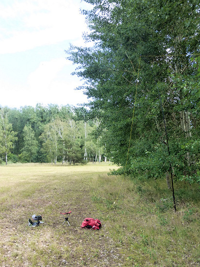 The day before there were thunderstorms.
Therefore the day should not only be sunny and hot but also humid.
For this reason, I was looking for a place that both provided shade and allowed a draft.
There was nothing to discover from the wet meadows.
Most of the meadows had been mowed shortly before and the ground was dry.
Therefore, I chose the edge of a meadow, which lies in the shade of a small grove right here.
In the Igelpfuhl, which is located on the other side of the grove, I could not find any water.
Directly on the northern border of the nature reserve there is a 209-hectare solar park.
Already during the preparation for this DLFF activation, I asked myself whether there would be radio interference.
I had set up the station less than 200 m from the solar panels.
At 17 and 20 m I did not notice any disturbances.
At 30 m, the noise level temporarily rose to S2, but then disappeared again completely.
However, this changed when switching to 40 m.
Crackle disturbances with a level of S6 made any reception impossible on this band.
Within 2¼ hours I was able to reach a total of 28 QSO's in all parts of Europe at 17, 20 and 30 m.
For the 3,5 km long way back to the railway station I used the same way.
Weather: initially sunny later partly cloudy, up to 30 °C, weak southeast wind with 10 km/h (2 Bft), 30 % chance of rain
DLFF-0850 - Weesower Luch (2.7.2022) ![]()
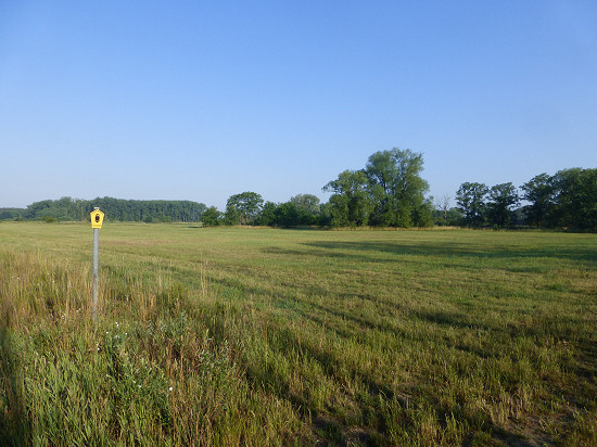 Near the small wown of Werneuchen is the Nature Reserve Weesower Luch DLFF-0850.
I was already there last weekend before the heat drove me away, among other things.
This time I used the earliest train, which reaches the railway station of Werneuchen, because I wanted to be there in the cool morning (20 °C).
And I also wanted to look for another location.

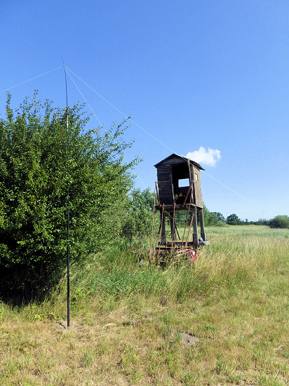 A moat forms the southern boundary of the nature reserve.
Along this ditch there is a so-called wet meadow, but it was largely dry and was mowed only recently.
And there are at least 3 high seats that can be reached from a driveway.
I chose the last one that stands right here.
By the way, in the immediate vicinity is the Igelpfuhl, in which I could not discover any water this time either.
I set up the station below the high seat.
There is a heavy concrete slab that protects the high seat from tipping over.
The radio interference detected a week ago at 40 m was again present.
But this time I tried to become active on this band too.
At least I could hear strong stations and thus reach them.
However, it was not a pleasure.
Nevertheless, after 1⅓ hours on 20, 30 and 40 m there were a total of 23 QSO's more in the logbook.
For the 2,7 km long way back to the railway station I used the same way.
Weather: sunny, 10 o'clock 20 °C, 17 o'clock 26 °C, weak westerly wind with 10 km/h (2 Bft), 20 % chance of rain
DLFF-0858 - Schwarzer Tanger (9.7.2022) ![]()
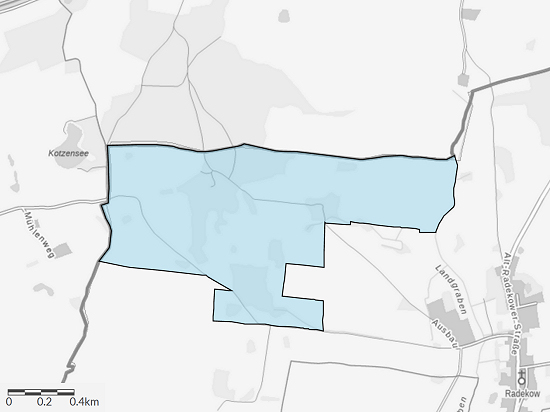 Northwest of Radekow, a district of the municipality of Mescherin, lies the 153-hectare Nature Reserve Schwarzer Tanger DLFF-0858.
Even Wikipedia does not offer much more information.
But at the Landesamt für Umwelt the following can still be read:
"The area is a large-scale open landscape with a low proportion of trees.
... It is predominantly characterized by arable land in which a large number of different wetlands are embedded."
To the north, the area continues seamlessly as the Großer Tanger, but is not a nature reserve there.

As a starting point for the hike I chose the railway station Tantow.
To Radekow I used a small, very little used road and from there a drive way between grain fields.
Within the nature reserve there are only a few public paths.
Already at home, I had therefore chosen a place at the end of one of these paths.
The above-mentioned LfU describes this point in the list of biotope types as "near-natural deciduous forests and deciduous-coniferous mixed forests with native tree species", through which an "unpaved path" leads.
There begins a "row of trees, more or less closed".
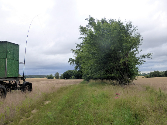 The drive way continues along the row of trees.
On a small elevation and near a hunting high seat I built the station here.
At the announced time, the first short rain showers fell.
In addition to the sounds of the raindrops on the jacket, there were also increasing cracking noises from the headphones.
In order not to be surprised by the thunderstorm, I dismantled the station again during a rain break.
Nevertheless, I was able to reach a total of 45 stations from Europe and one from North America in 1½ hours of radio operation at 17 and 30 m.
For the slightly more than 5 km long way back to the railway station Tantow I used the same way.
Shortly after I arrived at the railway station, the thunderstorm that had already been heard before fell.
Weather: initially overcast, later additionally some rain, 10 o'clock 17 °C, moderate north wind with 20 km/h (4 Bft), 50 % chance of rain
73/72 de Ingo, DK3RED - Don't forget: the fun is the power!